Orthomosaic Maps: A Practical Guide for Construction and Property Teams
What an orthomosaic map is, when it helps, and how to plan a drone mapping flight that produces a useful site reference.
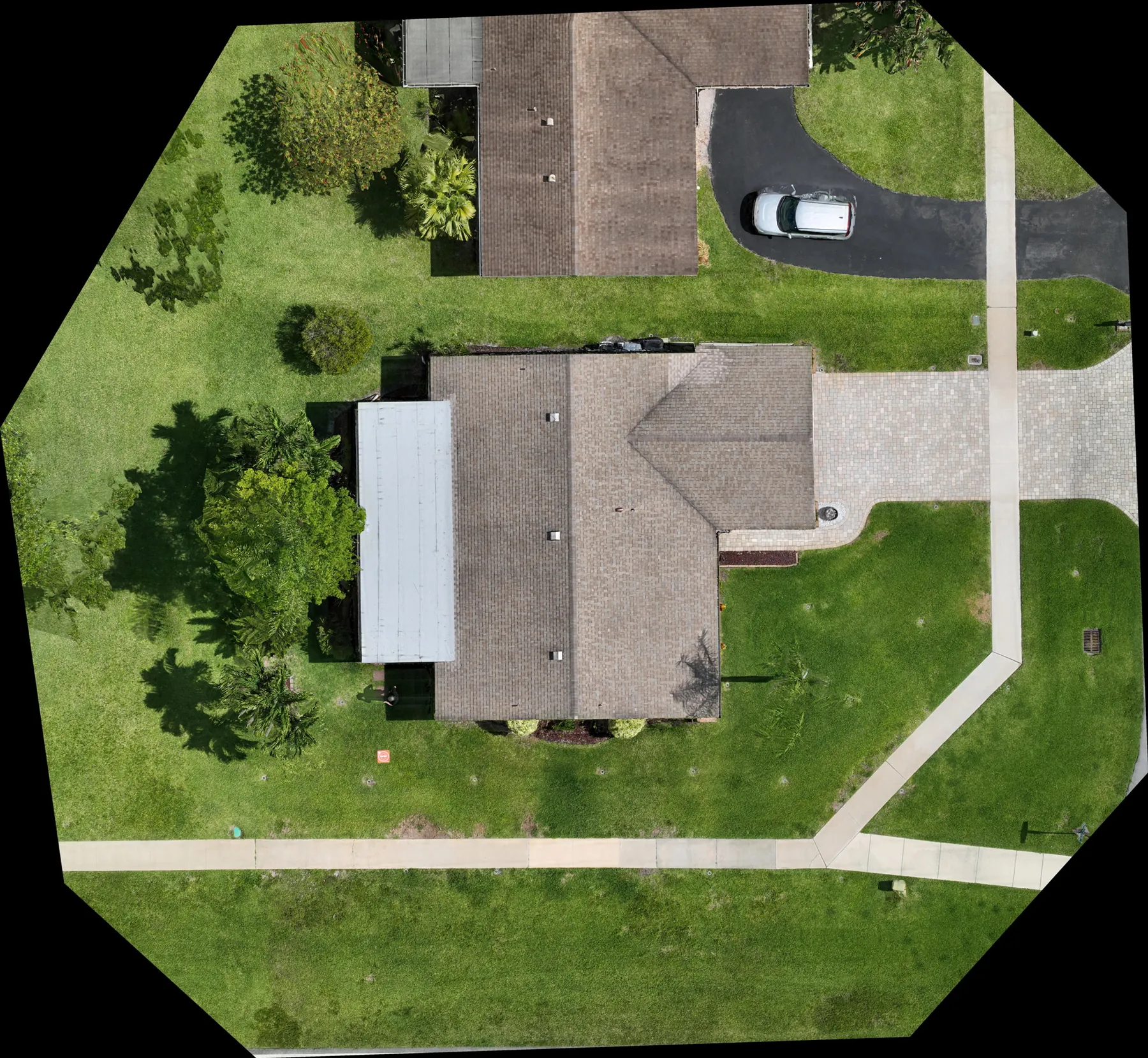
An orthomosaic map is a detailed overhead image made from many overlapping photographs. For a construction, property or land team, it can turn a site that is hard to understand from the ground into one clear reference. Roads, buildings, staging areas, drainage features, parking, open land and site access sit in the same view, so a conversation can start with the place everyone is actually discussing.
The useful distinction is simple: an attractive aerial image shows a site from above, while an orthomosaic is prepared to behave more like a map. It can be a practical backdrop for a progress meeting, a planning discussion or a visual record at a point in time. It is not automatically a survey, a boundary document or proof that every measurement is suitable for a design, legal or regulatory decision. The right use depends on the question, the capture plan and the accuracy the decision requires.
What is an orthomosaic map?
An orthomosaic begins with a planned set of overlapping aerial images. Processing aligns those images and corrects them into one continuous, top-down view. The Federal Geographic Data Committee describes an orthoimage as georeferenced imagery in which displacement from sensor orientation and terrain relief has been removed, giving it the geometric characteristics of a map while retaining the visual detail of a photograph. That is why an orthomosaic can be much easier to use than a single oblique drone photo when the team needs to orient itself around a real site.
Think of it as a visual site base. Instead of asking whether a feature is near the north drive or behind the warehouse, a reviewer can see its relationship to the building, pavement, tree line and surrounding access. A construction manager might use it to frame a progress update. A property team might use it to explain circulation, exterior work or a visible condition before arranging a closer review. A land team might use it to make an early site conversation more concrete.
The output still needs context. A map that looks precise can be misunderstood when nobody knows the capture date, coordinate system, resolution, visible limitations or intended use. Those details belong with the delivery, especially when more than one consultant or stakeholder will rely on the image.
When an orthomosaic is the right deliverable
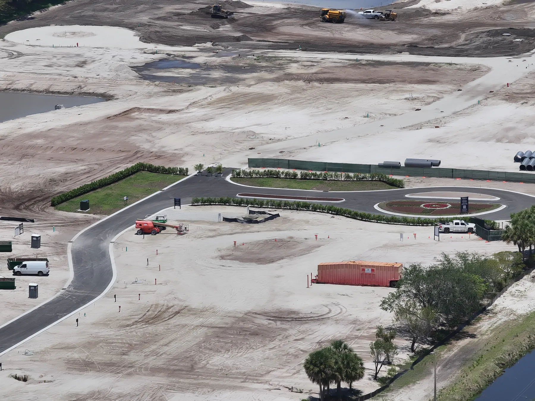
The best reason to request an orthomosaic is that a team needs an overhead reference, not simply that a drone will be on site. It can be especially helpful at the start of construction, after site clearing, during grading and utilities, before a project meeting, after a major exterior change or when an owner needs a current visual baseline. Because the image puts the whole footprint in one frame, it can help remote stakeholders ask better questions before they visit.
It is also useful when a site has several moving parts. On a commercial project, that may mean building pads, access points, laydown areas, parking, drainage and adjacent roads. On a large property, it may mean roofs, loading areas, landscaping and a visible relationship between separate buildings. For an existing building where the main question is a roof or facade condition, a focused aerial roof review or facade documentation flight may be the clearer starting point. The deliverable should match the decision, not the novelty of the technology.
A good brief names the question in plain language. For example: create a repeatable overhead baseline before utilities are covered, show the current circulation around an occupied warehouse, or give the project team a site-wide reference before a coordination meeting. That one sentence makes it easier to choose coverage, timing and output without collecting images that nobody will use.
How the capture plan shapes the final map
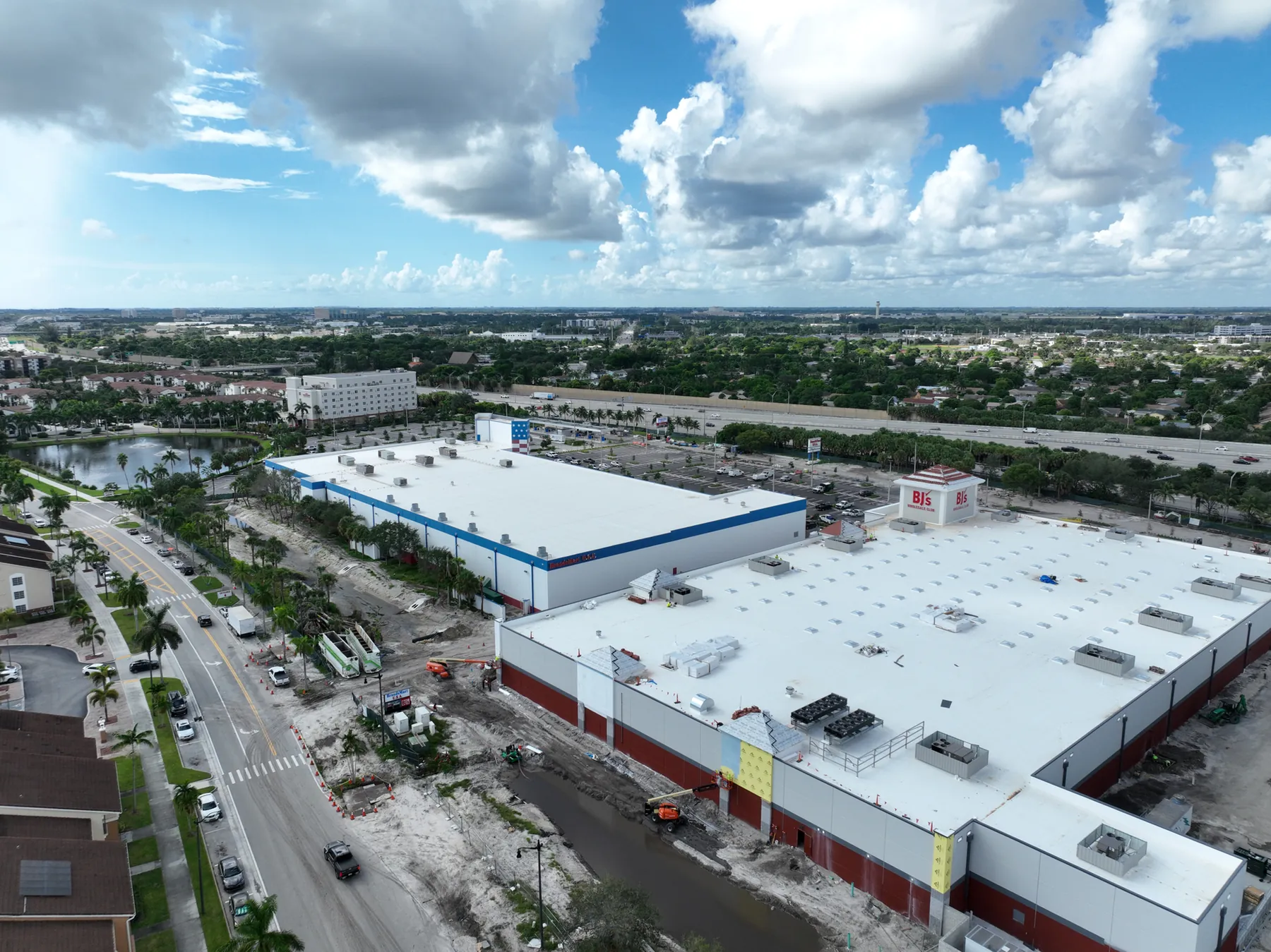
An orthomosaic is planned before the first image is taken. The flight needs enough overlap between images, a practical height and resolution for the site, suitable light and conditions that allow important areas to be seen. The team should identify temporary obstructions, active work, vehicles, security-sensitive areas, tree cover, water, reflective surfaces and locations where the ground cannot be observed from above. Those are not minor production details. They directly affect what the finished image can show.
The site itself matters as much as the aircraft. Tall buildings, cranes, poles, trees and changes in elevation can create hidden areas or visible seams. Moving equipment and traffic can change between frames. A clear capture plan accounts for these conditions and tells the client where the visual record is strong, where an area was not visible and what may need a separate ground-level record. Honest limitations make the map more useful, not less.
Commercial drone flights also need to be planned around the operating environment. The FAA's commercial operator guidance explains that Part 107 work has operating requirements, including airspace and visual-line-of-sight considerations. A property contact does not need to manage those rules, but sharing access details, operating hours, active hazards and restricted areas early helps the pilot plan a safe, sensible visit.
What an orthomosaic can show, and what it cannot prove
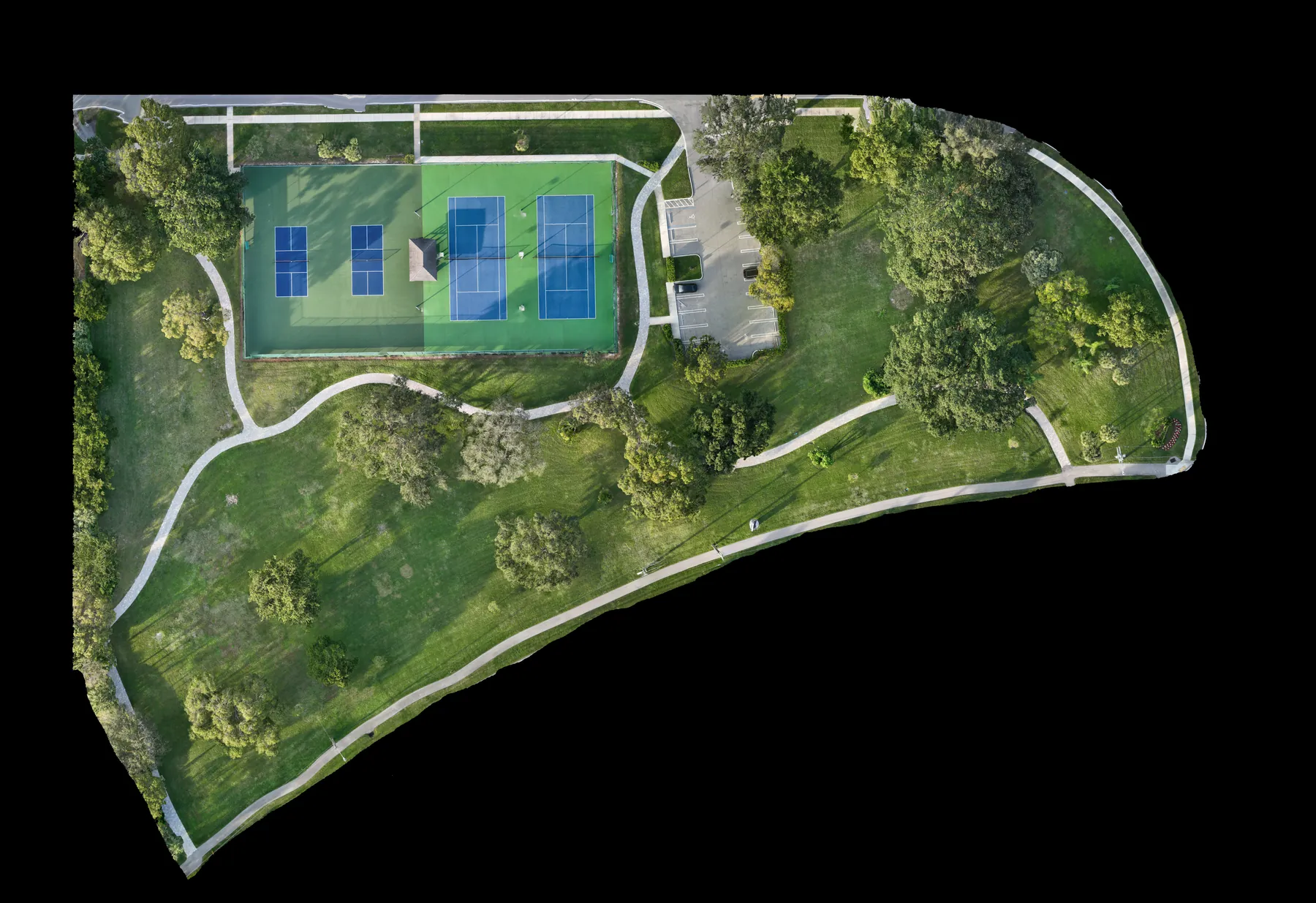
A well-planned orthomosaic can show visible site context at the time of capture. It can make building footprints, pavement, access, visible grading patterns, exterior work, landscaping, equipment locations and broad changes easier to discuss. It can also give a reviewer a convenient way to locate supporting photographs or make a short list of areas for closer attention.
It does not establish a legal boundary, replace a survey, certify grades, confirm drainage performance, prove concealed conditions or substitute for engineering, inspection or construction documentation. Accuracy requirements vary widely. A visual reference for an owner update is a different product from survey-grade work needed for design, staking, quantity calculations or a boundary decision. If the decision depends on a stated tolerance, coordinate system or legal conclusion, involve the appropriate licensed surveyor, engineer or other qualified professional before relying on the image.
That distinction is not paperwork for its own sake. It keeps the right people from making an expensive decision from a file that was meant only to give visual context. The best aerial mapping work makes the next expert conversation faster and clearer. It does not pretend to eliminate the expert when the question needs one.
A practical request checklist
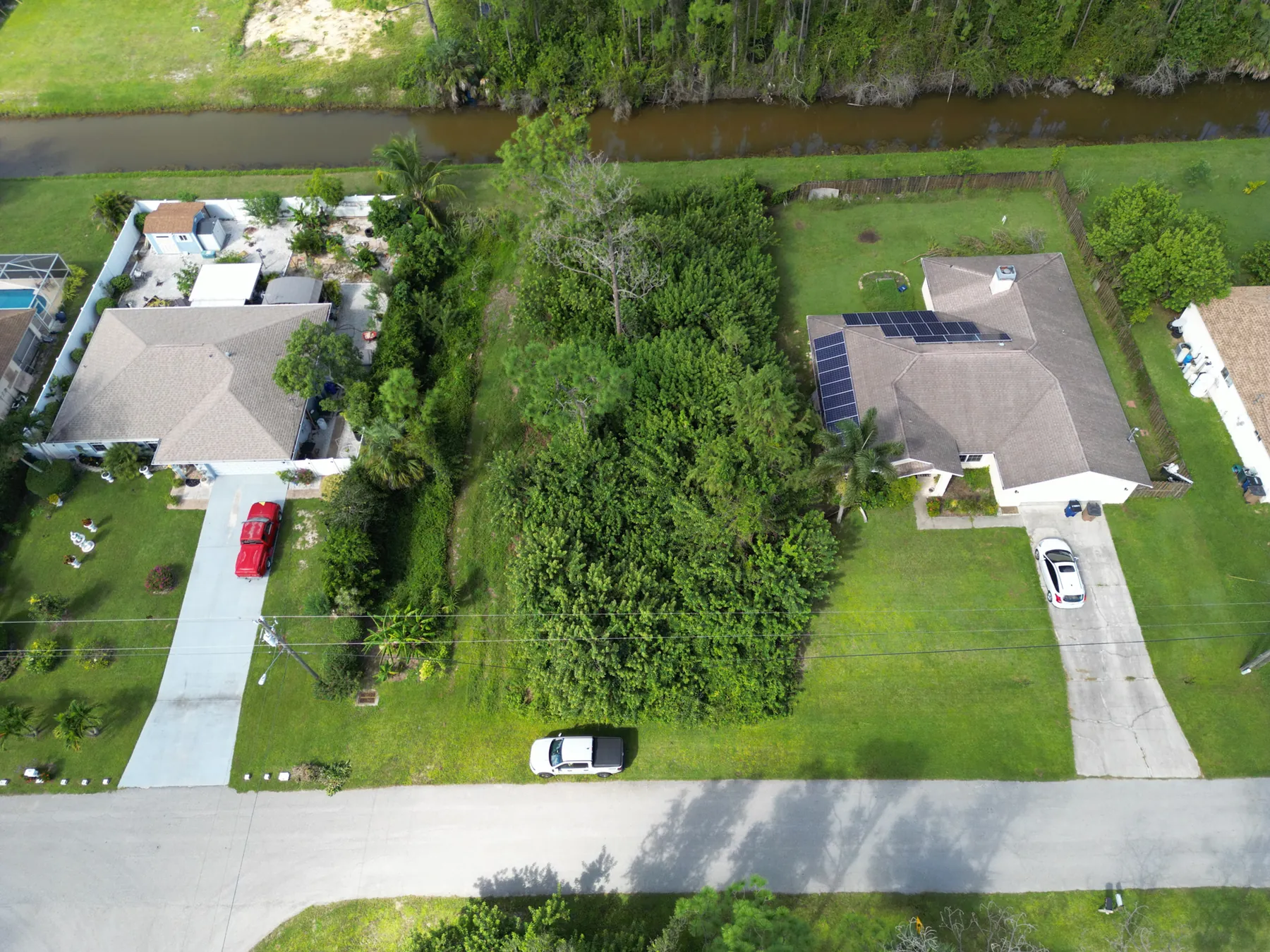
Before scheduling, provide the site address, the purpose of the map, the people who will use it, the desired timing, known access constraints and the parts of the site that matter most. A current site plan, marked-up aerial, prior map, utility plan or a few reference photos can help explain the job. Flag ongoing construction, tenants, deliveries, gates, temporary structures, sensitive areas and any locations where the pilot should coordinate with a site contact.
Then agree on the handoff. Ask how the file will be labeled, what area it covers, when it was captured and what supporting photos or notes will accompany it. If repeat coverage is planned, decide which overview should be recreated and how the visits will be dated. Consistency is what lets a series of maps become a useful timeline rather than a set of similar-looking files.
For a project that needs recurring visual context as well as a one-time overhead reference, pair the map with construction progress photography. The map gives the broad site picture, while repeat photography can show the elevations, details and milestones that need a different angle.
How West Boca plans mapping around the decision
West Boca Aerial Photography plans a mapping assignment around the decision the image needs to support. That can mean a site-wide overview for a construction team, a clear visual baseline for a property owner or a repeatable record for a project moving through visible phases. The goal is a purposeful flight and a handoff that a person who was not on site can still understand.
For an overhead reference, the team can coordinate a drone mapping service with commercial imagery or repeat progress coverage when the site needs more than one type of visual record. Share the address, project stage, audience, deadline, priority areas and any current site reference, then request a flight plan. That gives the assignment a clear job before the first flight path is drawn.
Frequently asked questions
What is the difference between a drone photo and an orthomosaic map?
A drone photo is a single image from one camera position. An orthomosaic is built from many overlapping aerial images that are aligned and corrected into one continuous overhead view. That makes it more useful as a visual site reference, while the right level of accuracy still depends on the capture method and the decision being made.
Can an orthomosaic be used for measurements?
It may support measurements when it has been produced to the accuracy required for the intended use, but not every orthomosaic is appropriate for every measurement. A visual planning map, a project-progress reference and survey-grade work have different requirements. When a decision depends on a stated tolerance, boundary or legal conclusion, use the appropriate licensed surveyor or other qualified professional.
What should I send before requesting a drone orthomosaic?
Send the address, the decision the map needs to support, the deadline, priority areas, site contact, access instructions, active hazards and any useful reference material such as a site plan, marked-up aerial or prior image. Explain whether the output is a one-time visual baseline or part of repeat coverage.
Can an orthomosaic replace a construction survey?
No. An orthomosaic can provide valuable visual context and help teams locate visible site features, but it does not replace a survey, boundary determination, engineering analysis, inspection or other professional service when the project needs those conclusions.
Related posts
Construction Progress Photography: What to Capture and When
A practical capture plan for owners, contractors and project teams who need a clear visual record of a job as it moves.
Read the guide →Construction Aerial Drone Photography: A Planning Guide
How to plan aerial construction photography that gives project teams useful site context, repeatable records and clear updates.
Read the guide →
Drone Solar Panel Inspection: A Planning Guide
What a drone inspection can show, how thermal imaging fits in and what to define before a solar site is flown.
Read the guide →