Elevation Context
Oblique aerial views show an exterior elevation in relation to roof edges, loading areas, adjacent structures and access points, so visible details have a useful location.
A clearer exterior record for property maintenance, specialist follow-up and the next building decision.
Commercial facade concerns are often easy to describe and difficult to place. A facilities team may see staining near an upper window, a contractor may need a better look at a parapet, or an owner may be asked to review a visible exterior condition from another office. Ground-level views can leave out the height, adjacent details and wider building context that make the next conversation more productive.
Drone facade inspection services create a practical aerial record of visible exterior conditions before a qualified specialist visits. West Boca Aerial Photography starts with the reason for the review, then plans coverage around the elevations, features and locations that matter. Broad oblique images establish the building and the relevant side. Closer views can then show visible details in relation to windows, roof edges, loading areas, access points or nearby equipment.
That sequence helps a property manager, owner, contractor, insurer or remote stakeholder discuss the same exterior area without relying on an isolated close-up. It can be useful for offices, retail centers, warehouses, multifamily properties, hotels, public facilities and active commercial sites where access, height or daily operations make an immediate hands-on review impractical.
For a portfolio with several buildings, the value is consistency as well as access. A planned set of elevation views can establish a dated baseline before a maintenance program begins, provide visible context after a weather event or give a future reviewer a way to compare the same exterior area without starting from scratch. The right coverage is guided by the building, the question and the people who need to act on the visual record.
The deliverable stays honest about its role. Aerial imagery records what was visible on the date of the flight. It can make a maintenance discussion, contractor briefing or building review more focused, but it does not diagnose a facade condition, establish a cause, confirm hidden damage or replace the professional responsible for inspection and repair decisions.
Oblique aerial views show an exterior elevation in relation to roof edges, loading areas, adjacent structures and access points, so visible details have a useful location.
The flight can focus on the facade areas named in the brief, including upper cladding, windows, parapets, exterior equipment, signs, drainage features or a concern reported from the ground.
Images can be grouped by elevation, area and date, giving a property team or qualified specialist a practical visual record before a closer review.
A focused facade review starts before the aircraft leaves the ground. The property team can identify which elevations matter, describe the visible concern, share reference photos and note who will use the images afterward. That may include a facilities lead preparing a maintenance discussion, an owner reviewing a reported condition, a contractor deciding how to approach a site visit or an insurer asking for visible context.
During capture, the work moves from the whole building to the relevant elevation and then to selected details. Wide frames establish site access, roofline, building form and the relationship between exterior features. Medium and closer views document what can be seen without attaching a conclusion the camera cannot support. The resulting sequence is easier for a remote reviewer to follow than a folder of unplaced close-ups.
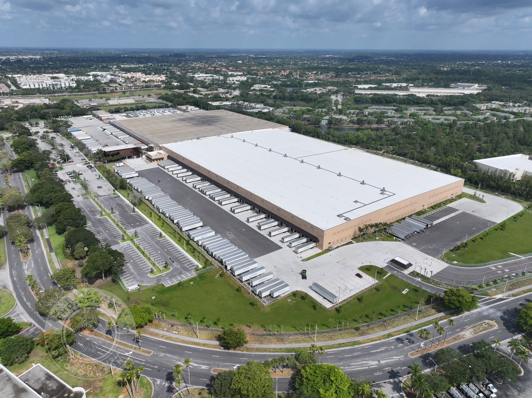
The useful views vary by building and question. A retail center may need a clear look at an upper storefront, canopy, sign band or exterior lighting area. A warehouse may need visible context around loading elevations, wall panels, roofline transitions or exterior equipment. A multifamily or hospitality property may need a broad visual record of balconies, upper windows and the way an elevation meets the surrounding site. The brief keeps the coverage specific without asking the imagery to make a judgment it cannot prove.
Site coordination keeps the flight aligned with the property. Active deliveries, pedestrian areas, parked vehicles, launch space, restricted views, work at height and privacy boundaries all influence a safe, respectful visit. The assignment is planned around those conditions as well as the exterior views that need to be clear after the flight.
Explore broader drone inspection services →Review pilot credentials →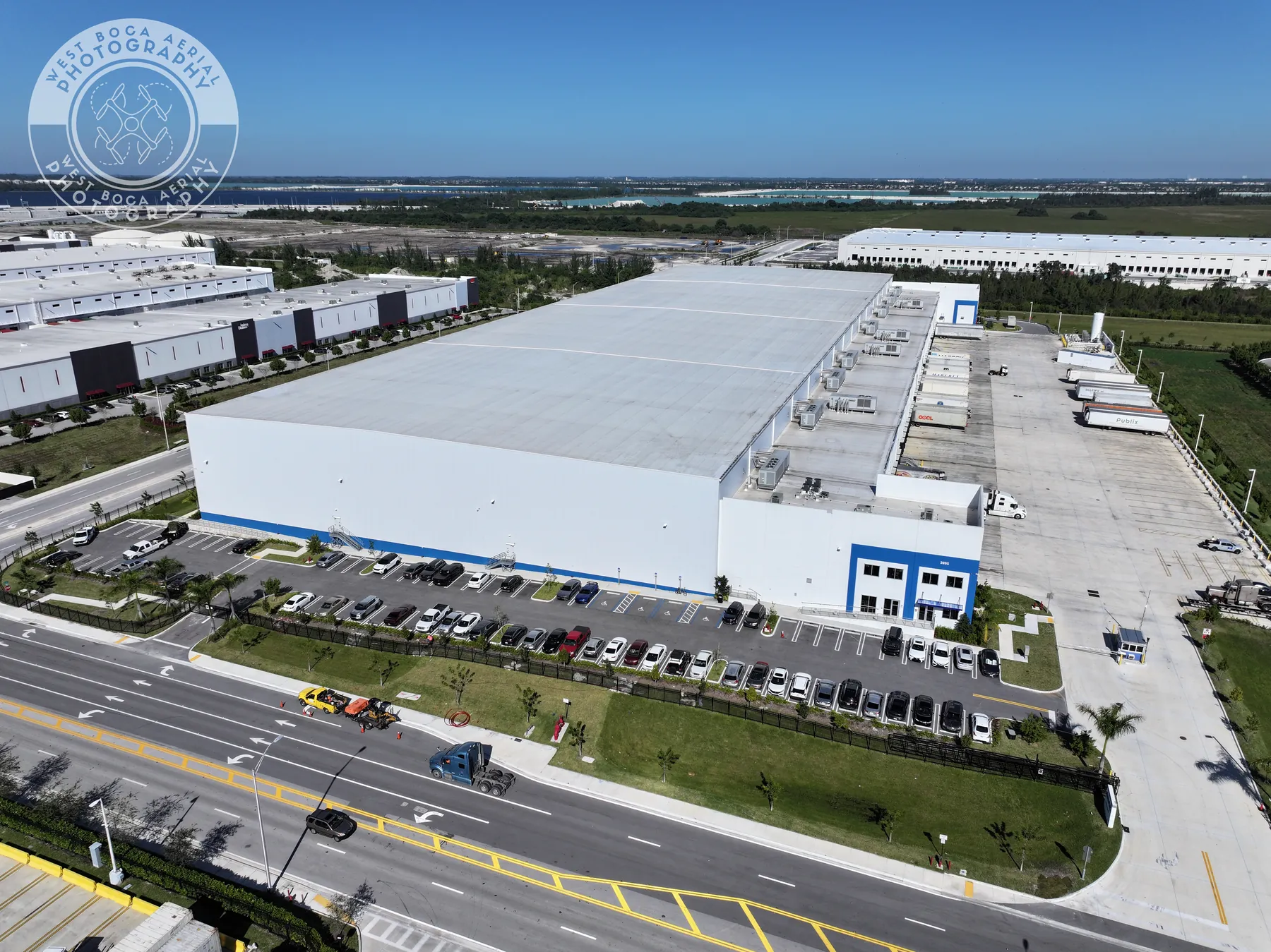
The team identifies what needs a clearer visual record. It may be an upper-elevation concern, a post-storm overview, a baseline before approved work, a visible condition around windows or cladding, or preparation for a specialist’s visit. The flight plan follows that real need.
Access, active work, pedestrian movement, weather, restricted areas and safe launch space shape a useful flight. Planning those details early keeps the visit focused on the requested exterior coverage and respectful of the work already underway.
Wide views establish the property and elevation. Closer views document the areas named in the brief, such as roof edges, windows, exterior equipment, cladding or visible staining. The camera records visible conditions, not a diagnosis or repair recommendation.
Images can be grouped by property, date, elevation and priority area. That organization helps ownership, maintenance teams, insurers and qualified specialists find the right image quickly without losing the wider location behind each frame.
When a team needs an ongoing property record, repeatable elevation views can be planned around the milestones or conditions that matter most.
Drone facade imagery is especially helpful when access is difficult, exterior features sit above normal viewing height or several people need to understand a concern before scheduling an on-site assessment. It can show building form, roof-edge relationships, visible exterior conditions, window and cladding context, access constraints and the location of a reported area within the larger property.
It is not a substitute for a building inspection, engineering opinion, facade assessment, safety review or repair recommendation. A visible image cannot establish what is behind a wall, determine the integrity of a component, identify the source of moisture or decide whether a condition needs a particular remedy. Keeping those limits clear helps the visual record support a sound next step rather than create false certainty.
The handoff can support a more efficient conversation, not a shortcut around professional judgment. A contractor can review the building orientation and visible area before arriving. A property manager can give an owner a clear point of reference. A specialist can identify which elevation or feature needs closer access. The aerial record is most useful when it complements the qualified follow-up, site knowledge and safety planning already required for the work.
For a broader roof, equipment or site review, the related drone inspection service can cover the wider property context. Properties with commercial solar arrays may benefit from a dedicated drone solar panel inspection plan. When a project needs repeatable imagery as work changes, construction progress photography may be a better fit. West Boca Aerial Photography helps shape the aerial coverage around the actual decision at hand.
A drone can document visible exterior conditions on hard-to-reach elevations, including cladding, windows, roof edges, parapets, exterior equipment, visible staining, joints, signage and the relationship between a concern and the rest of the property. It gives the next reviewer a clear visual reference.
No. Aerial imagery documents what was visibly present on the date of the flight. It does not determine the cause of a condition, verify hidden components, establish code compliance or replace an assessment by a qualified building, engineering, restoration or safety professional.
It is useful when a commercial property has upper elevations, exterior equipment or visible areas that are difficult to review from the ground. Teams often use it to prepare for maintenance, record visible conditions after weather, coordinate a specialist visit or give remote stakeholders a clearer view.
Share the property address, the reason for the review, elevations or areas of concern, access instructions, active work, site contact, known hazards, privacy boundaries and any reference photos or plans. That information helps focus the aerial coverage on the right visible questions.
Get a clearer exterior record before the next building decision.
Request a facade review plan →