Repeatable Views
Planned overview positions make it easier to compare the same building, work zone, access route or site edge as the project changes.
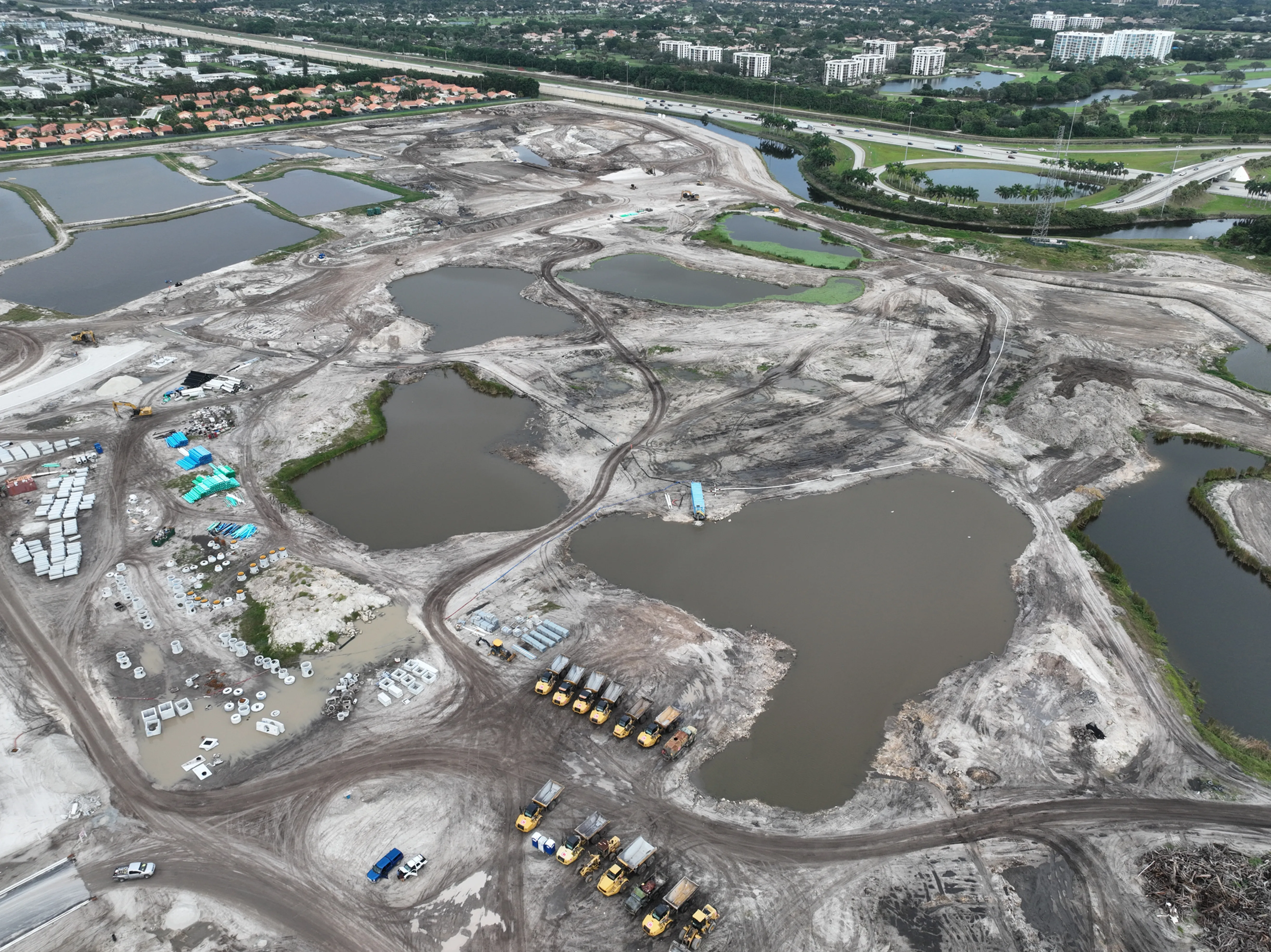
Repeatable aerial coverage for project teams that need progress, site context and milestones clearly documented.
Construction progress photography gives a project team a clear visual record without asking every decision-maker to be on site. A well-planned aerial view can show the full footprint of the work, the relationship between new and existing structures, work-zone boundaries, access routes, staging areas and the surrounding property in one frame. That broader view makes a current project condition easier to explain than a collection of isolated ground photos.
The real value is consistency. A single flyover can create a useful milestone image, but repeat visits become much more valuable when they begin from the same broad positions. An owner can compare the building pad from the same angle. A project manager can see how a roof, facade, parking area or landscape zone progressed since the last update. A remote stakeholder can orient themselves before reviewing closer details. The goal is not to make every visit look dramatic. It is to make each visit comparable.
West Boca Aerial Photography plans construction coverage around the project phase and the people who will use the final files. Early work may need a wide site baseline before grading, utilities or foundations change the ground conditions. Mid-project coverage may focus on structural progress, roof work, exterior systems, laydown areas and site circulation. Near closeout, the priority may shift to finished surfaces, access, landscaping, signage and the overall property presentation.
That planning keeps the finished set focused. Instead of delivering a large folder of near-duplicate angles, the coverage can move from full-site orientation to the work areas that matter, then to closer views of a milestone or condition. The result is easier to review in a project meeting, owner update, lender report or internal archive, even for someone who was not present during the flight.
Scheduling should follow the work rather than a calendar for its own sake. Monthly coverage can create a dependable baseline on a long project, while faster-moving stages may benefit from a visit before concrete is poured, after structural work reaches a key level, as the exterior closes in or before landscaping changes the finished presentation. The team can also plan a one-time visit around a specific milestone when the need is a documented record, not a recurring program.
Planned overview positions make it easier to compare the same building, work zone, access route or site edge as the project changes.
Aerial images can show the relationship between structures, staging, deliveries, parking, surrounding property and work already completed.
Files are grouped around the site, date and milestone so an owner, project manager or remote stakeholder can find the right view quickly.
Every project has moments that are difficult to reconstruct later. Site clearing gives way to grading. Underground work disappears beneath a slab. Structural progress becomes exterior enclosure. Equipment moves, staging shifts and access changes. Aerial progress photography can preserve the wider context around those moments while it is still visible.
Before a visit, define the purpose of the images. A superintendent may need an update for an owner meeting. A developer may want a dated record before a major phase is covered. A contractor may need to show how access or site logistics changed. A marketing team may need a polished current view that still accurately represents an active property. Those uses do not require the same image sequence, so the intended audience should guide the plan.
For a repeat program, the first visit establishes a small set of anchor views that can be recreated from one date to the next. The flight can then add current milestone views without losing the ability to compare the overall site. This approach gives a project team both continuity and enough flexibility to document conditions that become important as the work evolves.
Construction sites also change by the hour. Deliveries, cranes, temporary fencing, material storage, weather and active trades all affect what can be safely captured and what will be useful to see later. A short coordination call or written brief before the visit helps identify the right site contact, safe setup area, active hazards, restricted zones and timing windows. It protects the work underway while helping the pilot arrive ready to document the right conditions.
View construction field work →Explore construction and mapping →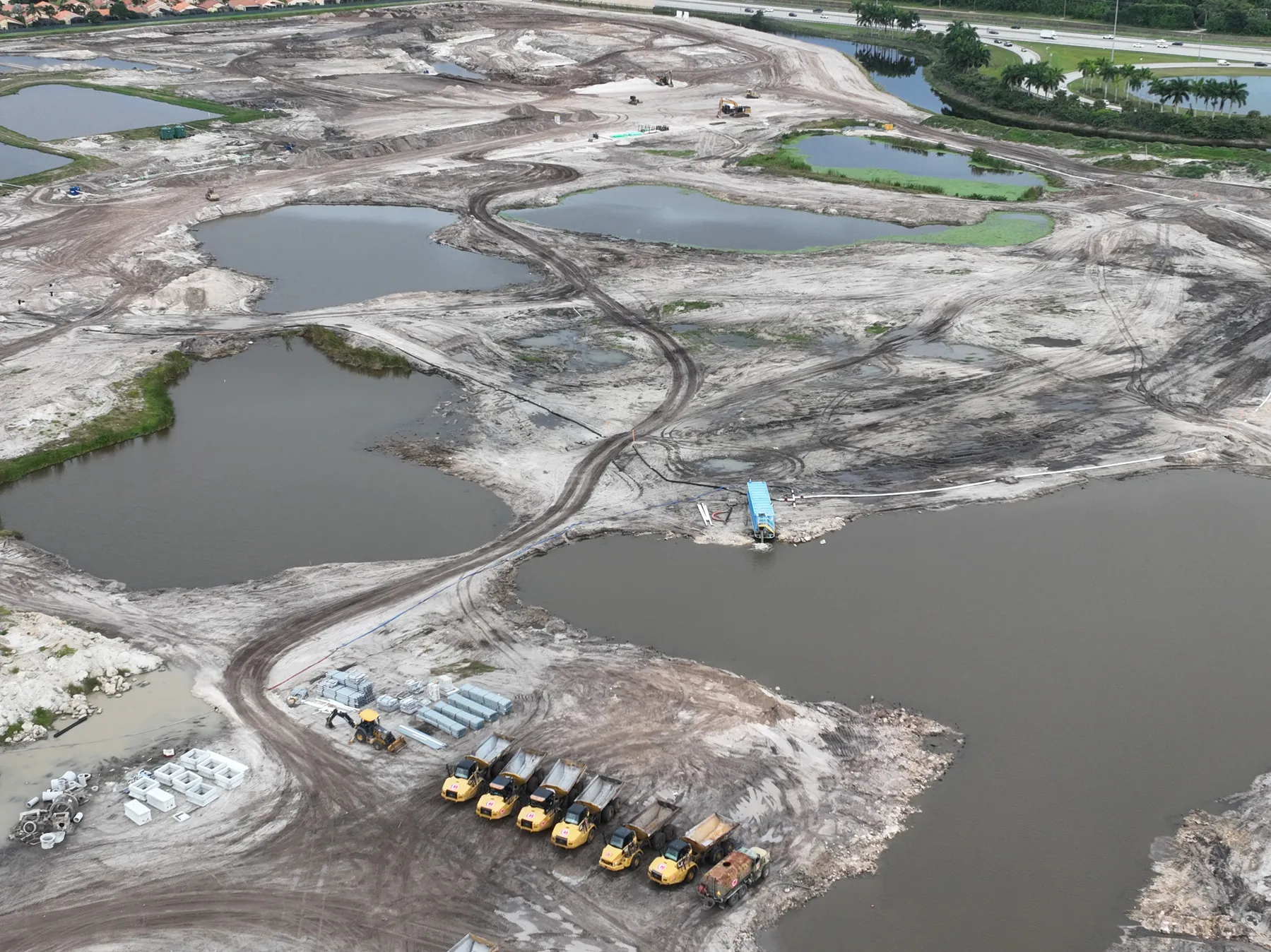
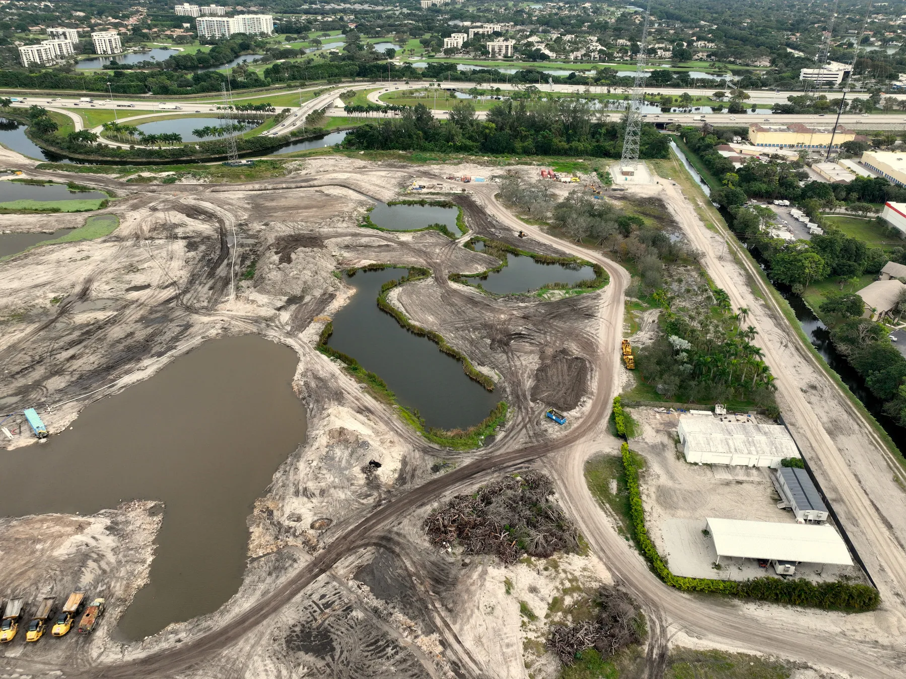
Start with the project phase, upcoming milestone and people who need the images. The site contact can identify active work zones, safe launch and recovery areas, restricted views, delivery traffic and any condition that should be documented before it changes. This preparation helps the flight focus on useful evidence instead of simply collecting more footage.
A broad overview establishes orientation. Medium-height views can show building areas, circulation, staging and the relationship between different trades. Closer aerial or ground images can document a specific milestone, exterior condition or feature. Moving from wide context to selected detail gives each image a location within the project.
Progress images should be easy to locate after the site has changed again. Files can be organized by project, visit date, phase or area so a client can pull the right material for a report, presentation or project archive. When repeat coverage is planned, matching anchor views give the team a practical before-and-after record without requiring them to sort through unrelated angles.
For an owner update or recurring construction record, the strongest delivery usually combines a concise selection for quick review with a complete, clearly labelled image library for the team that needs the full site history. That distinction keeps a progress report simple without losing the record that may matter later.
Construction progress photography is usually the right choice when a team needs a clear, current visual record with enough perspective to understand the site. It can show scale, sequence, exterior condition and the relationship between the work areas in a way that is quick to review. High-resolution stills are often the most practical format for owner updates, project documentation and repeat comparisons.
Aerial video can add movement and a broader sense of approach when the material is intended for a presentation, public update or stakeholder who needs a more immersive overview. It should support the project story, not replace the still images that make a specific date, area or visible condition easy to reference later.
Mapping serves a different purpose. When a team needs a measured overhead reference, consistent scale or a large-site view for planning, an orthomosaic or other mapping deliverable may be the better fit. West Boca can plan construction and mapping coverage alongside progress photography so the output matches the question: clear visual communication, a broad planning reference or both.
For projects where access, roof conditions or equipment deserve a closer look, the same visit may also be coordinated with thermal inspection coverage. Thermal imagery should be used carefully as a screening and documentation tool, with visible-light context and follow-up by the appropriate qualified professional when a condition requires further assessment.
When a project has multiple audiences, planning the file handoff early prevents the finished work from becoming another item to sort through. An operations team may want a complete record organized by area and date. An owner may need only the clearest current views and a short selection of milestone images. A contractor may need close context around a particular exterior or roof area. The capture and delivery can serve those different needs when they are named before the flight.
The right schedule follows the pace of the work and the decisions the images need to support. Monthly coverage works well for many longer projects, while active phases may call for weekly, biweekly or milestone-based visits. Repeating the same key views makes each visit more useful than a collection of unrelated aerial images.
A useful set usually includes a broad site overview, clear views of the active work areas, access and staging context, and selected closer images for meaningful milestones. The exact mix can include ground photography, video or mapping when those deliverables will help the project team use the record.
Yes. A planned aerial record gives people who are not on site a clearer view of progress, scale and changing conditions. Organizing the images by date and project area helps make updates easier to share in meetings, reports and owner communications.
Share the site address, current project phase, milestone to document, preferred timing, site contact, safe access and any restricted areas. A site plan, prior images or a short list of priority views also helps establish repeatable coverage from the first visit.
Keep the project record in view.
Request a coverage plan →