Roof-Wide Orientation
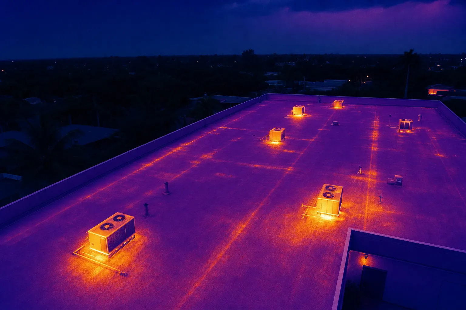
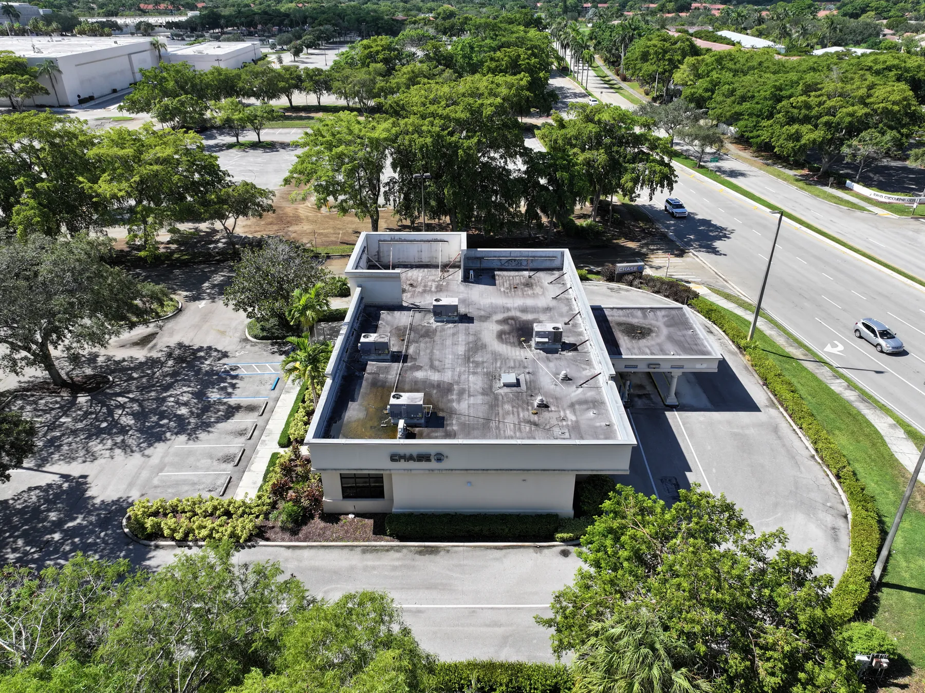
Wide aerial views establish roof sections, drainage paths, penetrations, equipment and access points, so every closer image has a useful location.
A clearer aerial record for roof maintenance, storm response and the next qualified review.
A commercial roof can be difficult to discuss when the people making the next decision are not standing on it. A property manager may be coordinating a maintenance visit from another office. An owner may need to understand a contractor’s concern. A team may need a current visual record after weather moves through, before work begins or while several roof areas are being considered at once. Drone roof inspection services create a practical visual reference for that conversation.
West Boca Aerial Photography starts with the reason for the review, then plans coverage from the whole property down to the areas that matter. A broad image can show how roof sections, drains, mechanical equipment, access points and adjacent structures relate to one another. Closer views can then be organized around a named location instead of leaving a reviewer to guess where a detail belongs.
That sequence is useful for large commercial roofs, multifamily properties, warehouses, offices, retail centers and facilities with several structures. It can help a team prepare a maintenance discussion, document visible conditions after a storm, build a before-and-after record around approved work or give a roofing professional a clearer sense of the site before scheduling a closer assessment.
It also gives the site team a consistent way to frame the request. Instead of asking for a general flyover, they can name the roof sections, visible concerns and people who will use the imagery afterward. That may include a facilities lead comparing a current image with a prior record, an owner reviewing a reported concern, a contractor preparing a site visit or an insurer asking for visible context. A purposeful flight plan keeps those needs connected without pretending that one image answers every roofing question.
The deliverable remains honest about its role. Aerial imagery shows what was visible on the date of the flight. It can make the next review more focused, but it does not diagnose a leak, certify a roof, establish a cause or replace the qualified professional responsible for inspection and repair decisions.
Wide aerial views establish roof sections, drainage paths, penetrations, equipment and access points, so every closer image has a useful location.
The flight concentrates on the areas named in the brief, such as a storm concern, standing-water location, repair area, equipment zone or section due for contractor review.
Visible-light imagery, and thermal context when it serves the assignment, can be grouped by roof area and date for a straightforward handoff.
A focused brief makes the final imagery easier to use. Before the visit, the site contact can identify the roof areas that need attention, explain the purpose of the review and share any plans, reference photos, recent maintenance notes or weather context. The pilot can then plan around roof access, active work, launch space, restricted areas, people on site and the views that need to be clear after the flight.
During capture, the work moves from orientation to detail. Property-wide frames establish the building and roof footprint. Section views connect a concern to drainage, parapets, penetrations, equipment or a nearby access point. Selected closer images document visible features without attaching a conclusion the image cannot support. That disciplined sequence gives a remote reviewer a much better starting point than isolated close-ups.
Afterward, files can be organized by property, date, roof section or priority area. The result can support an internal maintenance file, insurance conversation, contractor briefing or ownership update. A concise set of reference images can make the immediate discussion faster, while a complete library preserves the wider context for anyone who needs to look more closely.
Explore broader drone inspection services →Review pilot credentials →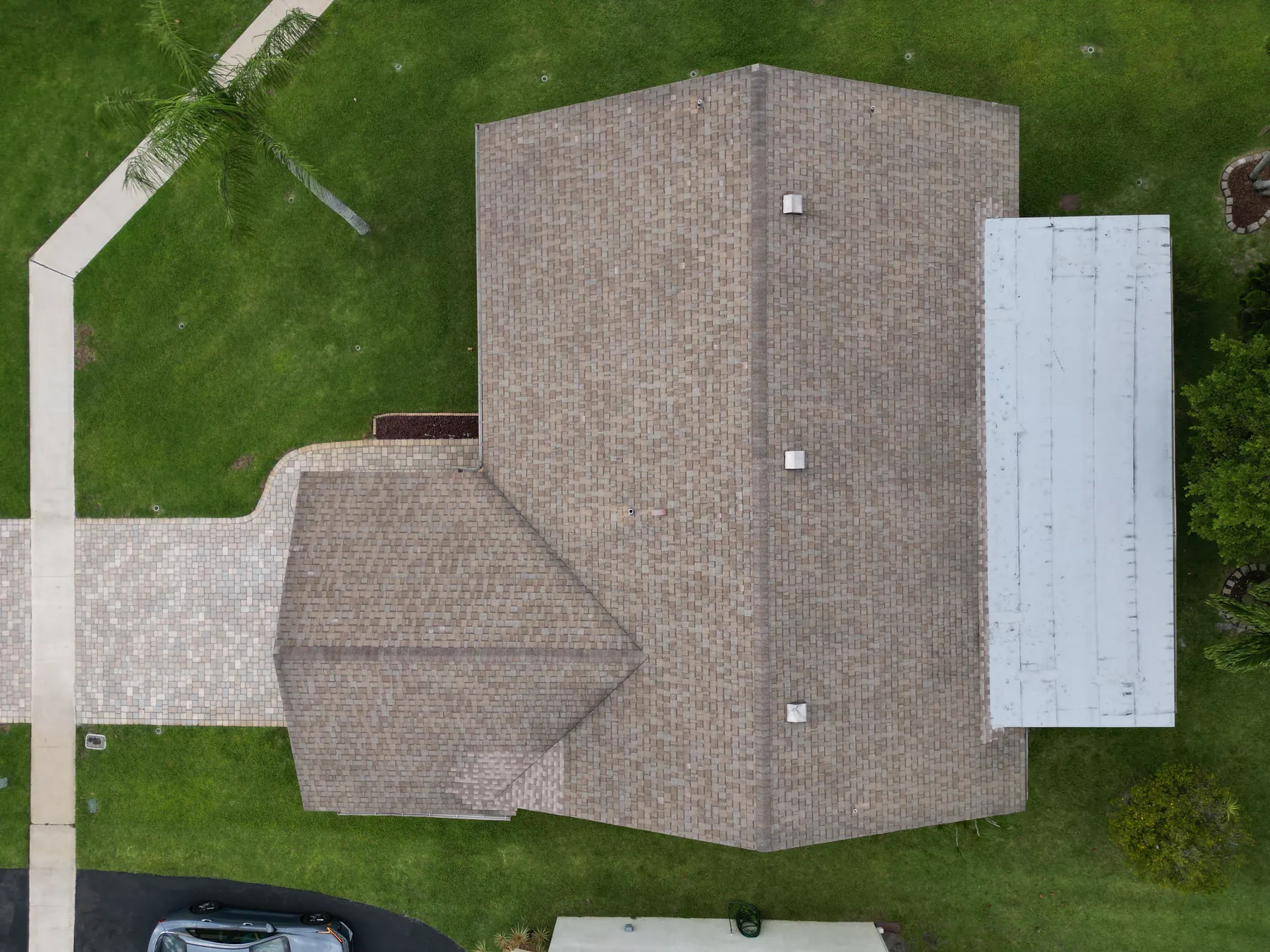
The team identifies what needs a clearer visual record. That may be a post-storm overview, a baseline before planned work, a visible condition near equipment, a drainage-area question or preparation for a roofing contractor’s visit. The flight plan follows that real need.
Access, active work, weather, rooftop activity, restricted areas and safe launch space all influence a useful flight. Planning these details early helps the visit stay focused on the requested coverage and respectful of the work already underway.
Wide views establish the roof layout and closer views document the areas named in the brief. The camera can record visible conditions, debris, water, equipment placement and surrounding context. It does not make a repair recommendation or convert a visible feature into a diagnosis.
Images can be grouped in the sequence a reviewer needs, from property overview to roof section to selected detail. That organization makes the material easier to share with ownership, maintenance, insurers or qualified roofing professionals without losing the location behind each frame.
When the assignment calls for thermal capture, it is planned as a supporting layer alongside visible-light imagery and the property team’s specific question.
Drone roof imagery is especially valuable when access is difficult, the property is large or several people need to understand an area before an in-person review. It can show roof shape, section relationships, equipment placement, visible surface conditions, drainage context and the location of a concern within the wider property. For teams managing multiple buildings or coordinating from a distance, that perspective can reduce ambiguity before the next conversation.
It is not a substitute for a roofing inspection, engineering opinion, moisture test, safety assessment or repair recommendation. A visible image cannot establish what is beneath the roof surface, identify the source of a leak or determine whether a condition requires a specific remedy. Keeping those limits clear helps the aerial record support a sound next step rather than create false certainty.
For a broader property, equipment or exterior review, the related drone inspection service can cover the wider site context. Properties with commercial solar arrays may benefit from a focused drone solar panel inspection plan. When a project needs repeatable visual documentation over time, construction progress photography may be the better fit. West Boca Aerial Photography helps shape the aerial coverage around the actual decision at hand.
A drone can document visible roof layout, rooftop equipment, drainage context, penetrations, debris, standing water, access points and areas that need a closer look. The imagery gives a maintenance team or contractor a clear visual reference before an in-person review.
No. Aerial imagery records visible conditions and, when planned appropriately, relative temperature patterns. It does not determine the source of a leak, the integrity of a roof assembly or the correct repair. A qualified roofing professional or other appropriate specialist makes those determinations.
Thermal imaging can add useful relative temperature context when the property team has a defined question and conditions support meaningful capture. Sunlight, wind, recent rain, roof material and timing all affect the image, so it is planned around the assignment rather than treated as a default diagnosis tool.
Share the property address, roof plan if available, reason for the review, priority areas, recent weather or maintenance context, active work, access instructions, site contact and any safety or privacy boundaries. Reference photos or marked-up plans can help focus the capture.
Get a clearer roof record before the next decision.
Request a roof review plan →