Real Estate Drone Photography Tips for Clearer Listings
A practical planning guide for brokers, owners and property teams who want aerial images to make a listing easier to understand.
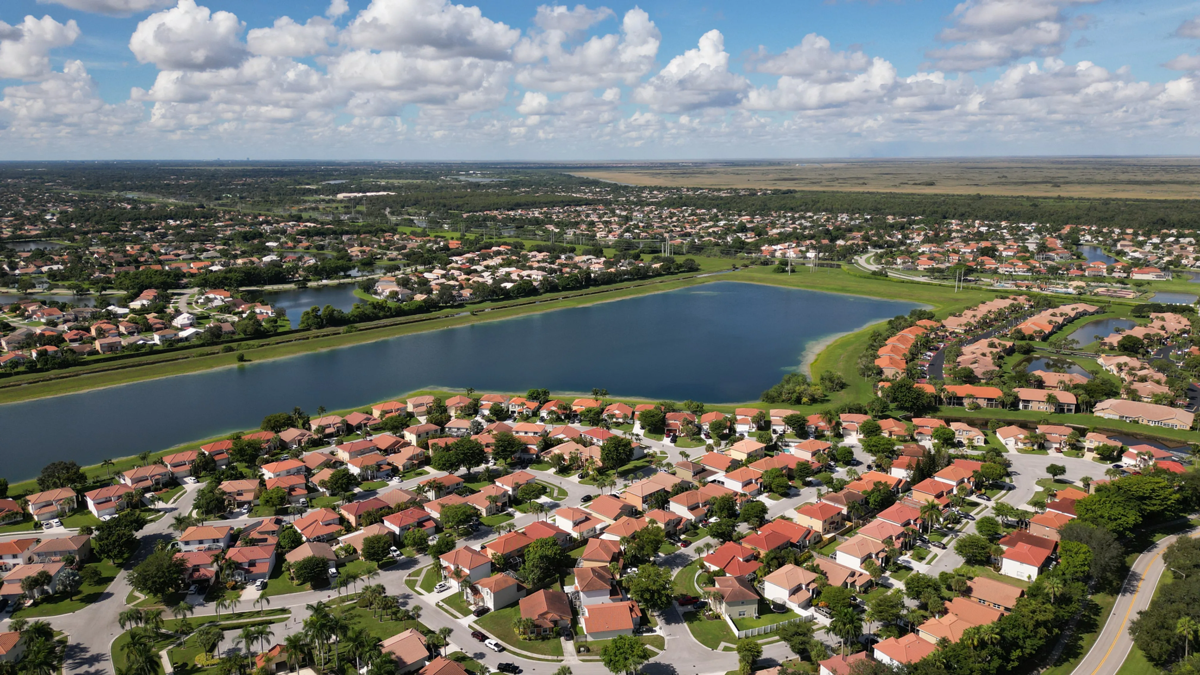
Real estate drone photography tips are most useful when they start with the buyer's question: what does this property actually feel like, and how does it fit into its surroundings? Aerial imagery can show the relationship between a building, its lot, outdoor spaces, access, nearby amenities and the wider setting in a way that a ground-level image cannot. The point is not to make every listing look like a resort. It is to make the features that matter easier to see before someone books a visit.
That requires a plan. A dramatic high-altitude image may show a broad area but hide the property itself. A tight roof-level image may look polished but omit the driveway, water view, parking or outdoor living space that helps a buyer understand the offering. The strongest aerial set uses a small number of deliberate views, each with a job. It also respects the limits of what an image can establish. Aerial photos can show visible context, not legal boundaries, square footage, property condition or facts that need professional verification.
1. Decide what the aerial images need to explain
Before scheduling a flight, identify the specific feature that is difficult to understand from the ground. It may be a large lot, a waterfront setting, a golf-course edge, a pool and patio, a corner location, a long approach, an amenity area or the relationship between a commercial building and its access. A simple brief keeps the image plan from becoming a collection of nice-looking but interchangeable views.
The best question is not “What drone shots should we get?” It is “What would a serious buyer want to see before making time to visit?” For a home, that may be the usable outdoor space and the way the house sits on the lot. For a commercial site, it may be parking, truck access, surrounding uses, visibility from an approach road or how several buildings relate to one another. The existing Miami aerial real estate service explains how a planned property flight can be organized around those real decisions.
Write down two or three visual priorities and one feature to avoid overemphasizing. That last part matters. Aerial coverage can make a nearby road, a tight neighbor relationship or an unfinished area more prominent than it is in person. An honest plan gives the property context without trying to disguise its setting.

2. Use a sequence of wide, medium and detail views
A useful aerial set usually starts wide, moves closer and then adds only the details that support the listing story. The wide view establishes where the property sits in relation to roads, water, parks, open space or neighboring development. The medium view shows the building, lot shape and main outdoor features together. Detail views can then make a pool, dock, roofline, courtyard, parking arrangement or distinctive architectural element easier to see.
This sequence gives the viewer context at every stage. A pool image is more valuable when a buyer can also see how it relates to the house and yard. A high overview is more useful when there is a second image that makes the building easy to identify. Keep the number of images focused. Repeating nearly identical angles makes a listing feel less considered, not more complete.
For a larger property or development, pair the aerial sequence with the right ground-level coverage instead of asking the drone to tell the entire story. West Boca's commercial imagery service can combine aerial and ground photography when a property needs both site context and a closer sense of its visible details.
3. Stage what the camera can actually see
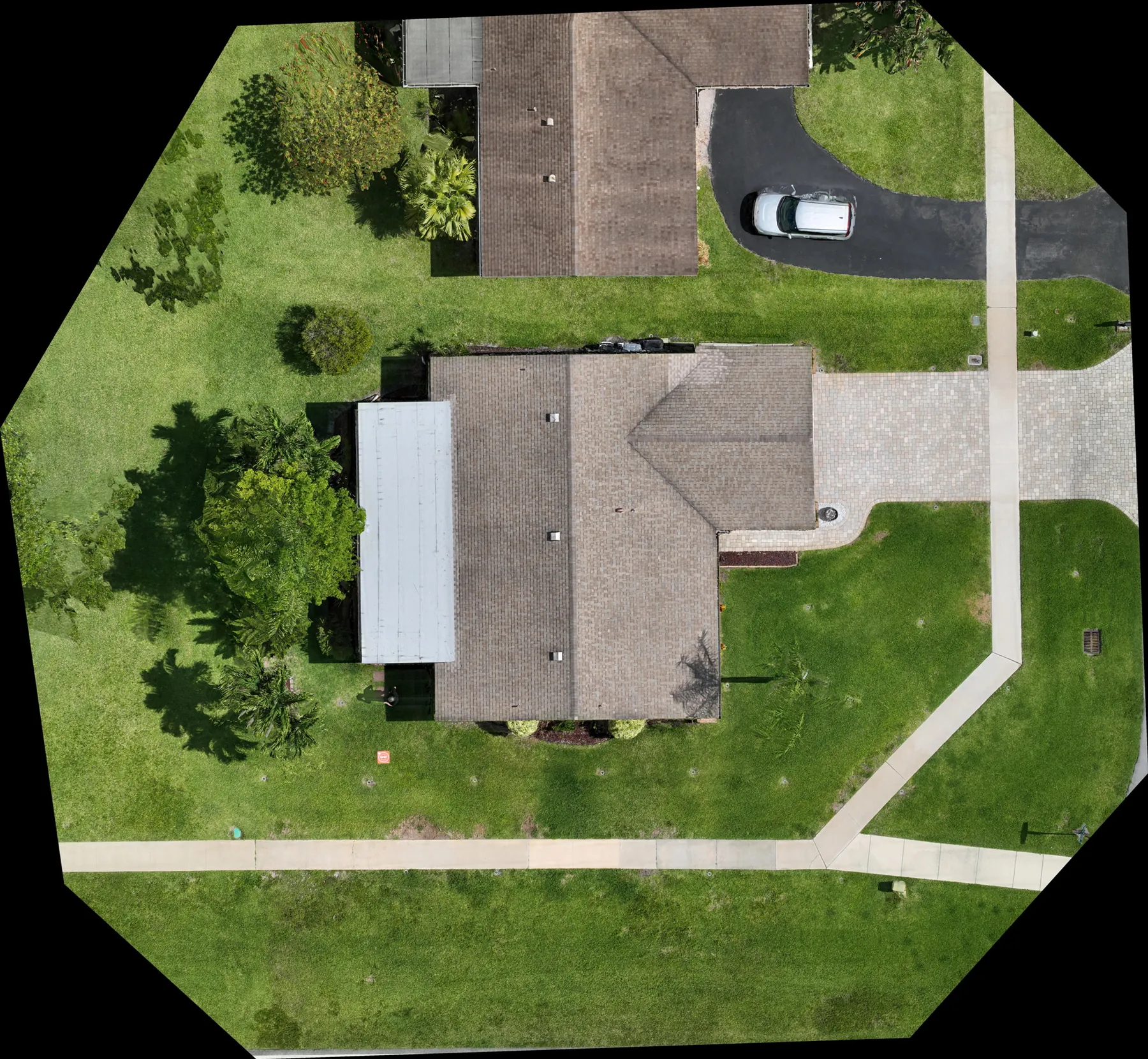
Aerial cameras reveal a different version of a property than a curbside photo. Roofs, driveways, side yards, patios, pools, trash bins, hoses, vehicles and construction materials can all become much more noticeable from above. Before the appointment, walk the exterior with the planned aerial perspective in mind. Clear loose items, organize outdoor furniture, move vehicles when practical and make sure the pool, driveway and main outdoor areas look ready to be seen together.
This is not about making a lived-in property look artificial. It is about removing visual noise so a buyer can understand its useful features. Redfin's exterior preparation checklist makes the same practical point: roofs, yards, patios, driveways and pool areas deserve attention because an aerial view sees them all at once.
Coordinate with occupants early. Ask about cars, delivery windows, pets, outdoor equipment, open gates, sprinklers and any activity that could interrupt the photography. That small conversation often makes the appointment smoother and prevents a strong image from being spoiled by something simple to move.
4. Plan for light, weather and real site activity
Timing changes the result. Low-angle light can give landscaping and architecture more shape, while a cloudless midday may make wide, factual coverage easier to read. Recent rain can leave reflective pavement or standing water. Wind, active maintenance, pool service, landscaping crews and road traffic can affect both the safety of the flight and what the camera sees. Share the purpose of the images so the photographer can recommend a sensible window instead of treating a time on the calendar as the only decision.
A weather backup should be part of the plan, especially for a listing with a narrow launch window. It is better to wait for clear, usable coverage than to force a flight that cannot safely deliver the views the property needs. A polished result comes from sound judgment, not from flying at the first available moment.
The flight plan also needs to respect operating conditions. The FAA's Part 107 guidance requires commercial operations to follow rules including visual line of sight, safe separation from people and applicable airspace authorization. The seller or broker does not need to manage those details, but should share access limits, active work and local conditions with the pilot before the visit.
5. Show context without making claims the image cannot prove
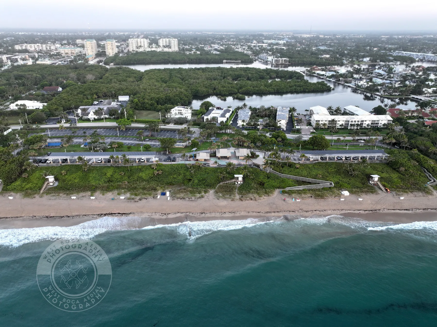
Aerial imagery is exceptionally good at showing visible context. It can show an approach road, a beach or park nearby, a property's position relative to open space, the arrangement of visible buildings and the relationship between a lot and its surroundings. Matterport notes that aerial imagery helps viewers understand exterior features and how outdoor spaces relate to the building, which is exactly where this format earns its place in a property presentation.
It is not a substitute for a survey, appraisal, inspection, title review or disclosure. Avoid drawing boundary lines unless a qualified source has supplied them and the listing team is authorized to use them. Do not imply that a view is protected, that a parcel reaches a particular point or that an aerial image verifies a property condition. Clear photographs and careful captions are more credible than a sweeping claim that creates a problem later.
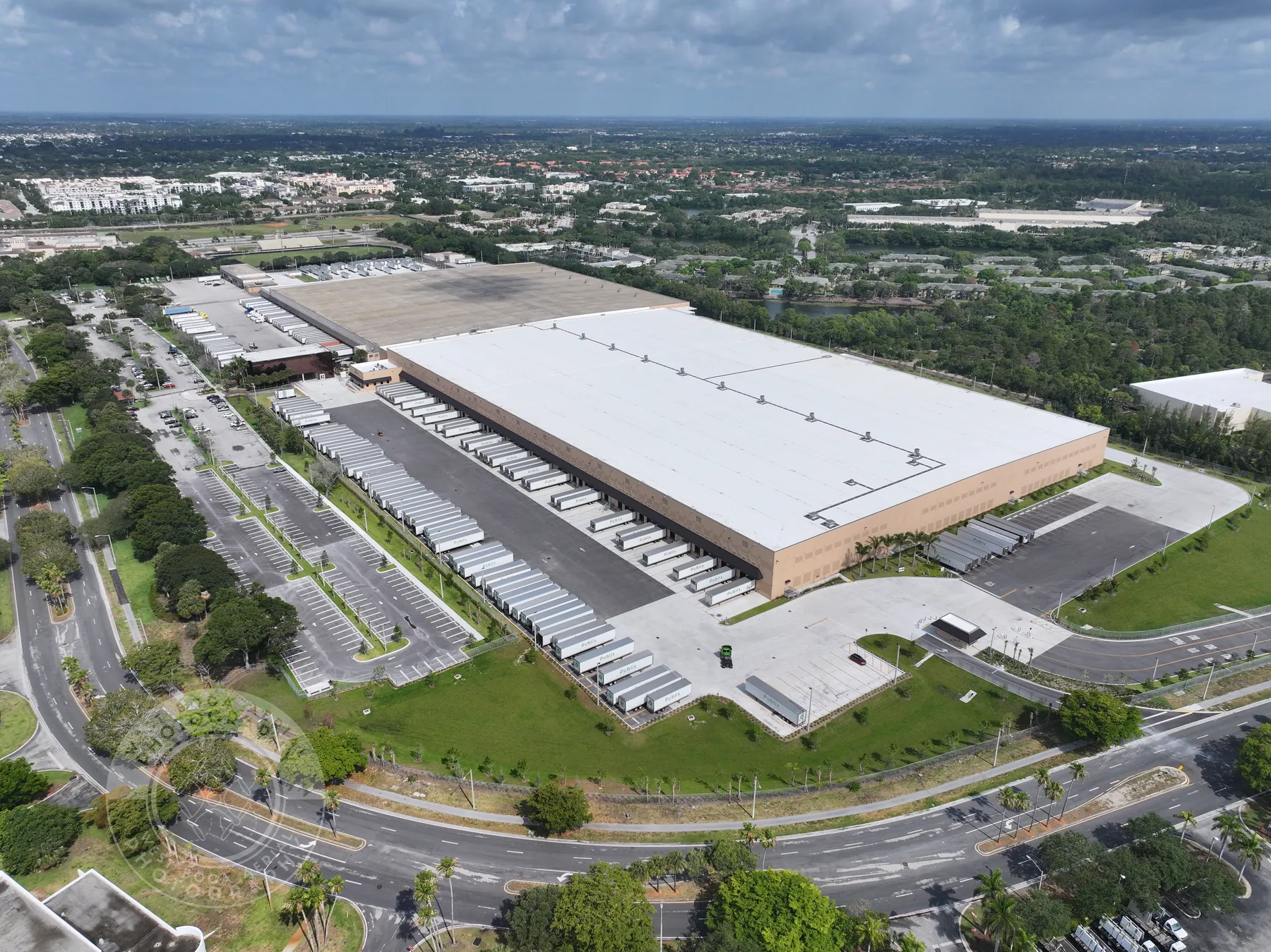
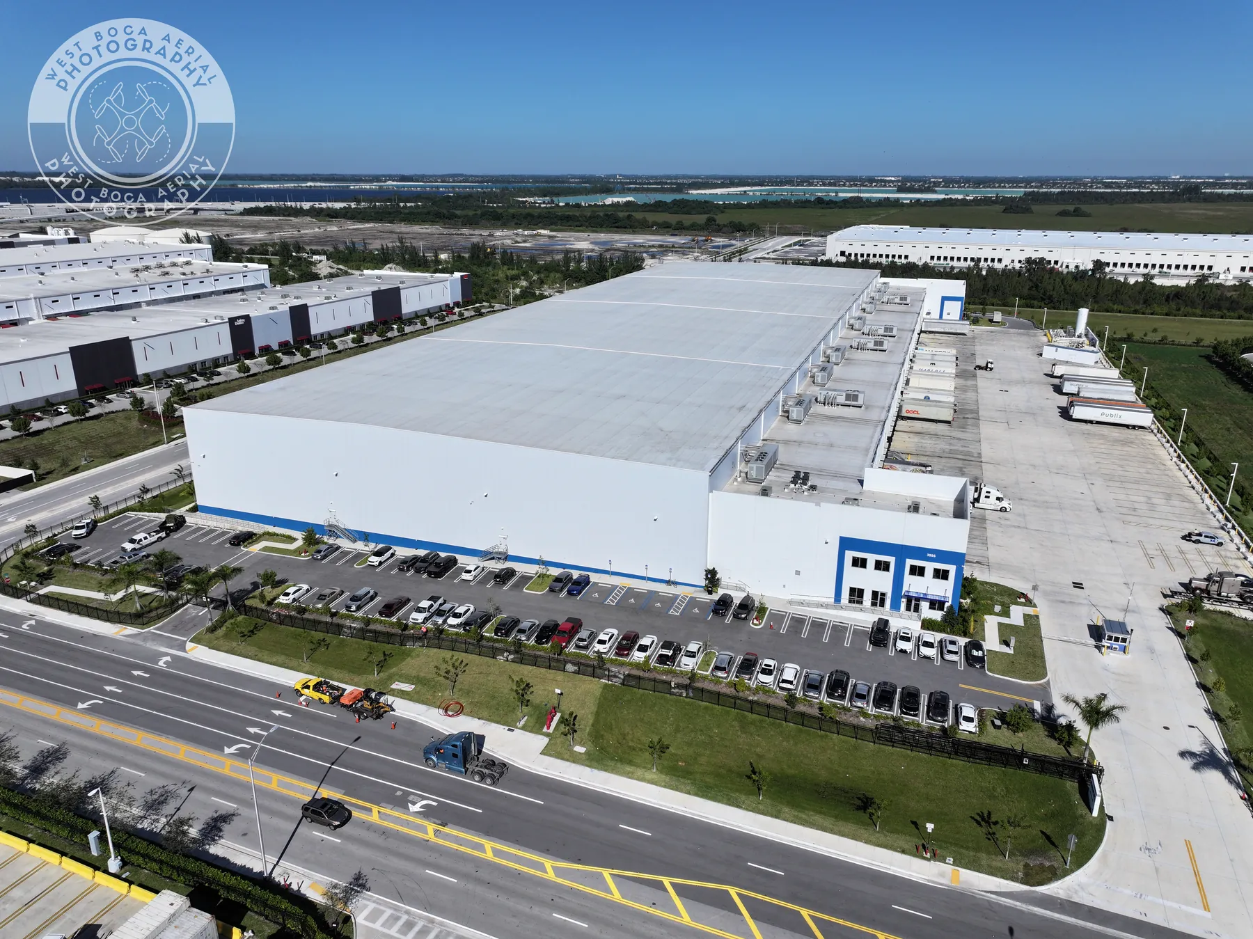
For commercial listings, this distinction is just as important. Aerial coverage can make access, parking, surrounding uses and site scale easier to see. It cannot establish traffic counts, zoning, capacity, legal access or the suitability of a site for a buyer's plan. Let the imagery do the job it can do well: make the visible property easier to understand.
6. Make the finished set easy to use across the listing
Aerial images are strongest when they are selected for a purpose, not simply delivered as a large gallery. Choose a lead image that makes the property recognizable, a context image that explains the setting and a few supporting views for the outdoor features that are most likely to matter to the buyer. The same set can then support the listing, a brochure, a social post, a presentation or a short property video without forcing every channel to use every frame.
Ask for files that make the selection process simple. A clear delivery can separate stills from video, preserve the strongest full-resolution files and make the key views easy to identify. When a property has several buildings or multiple priority features, a brief list of the intended uses can help the photographer organize the handoff in a way that serves the sales team instead of leaving them to sort through similar images.
Video should be planned just as deliberately. A slow, stable pass that shows arrival, approach and outdoor context usually gives a viewer more useful information than an elaborate move that makes the property difficult to read. For teams that need motion as part of the story, the commercial drone videography service can be scoped around a property's audience, intended channel and visual priorities.

7. Choose a pilot for planning, not only dramatic footage
A portfolio should show more than sunsets and fast edits. Ask to see examples where the property is easy to locate in the frame, where the light supports the subject and where the image sequence makes the lot or site easier to understand. A pilot who can ask the right planning questions is more likely to deliver useful images than one who begins with a generic shot list.
For paid commercial work in the United States, confirm that the pilot can operate under the appropriate FAA framework. The FAA explains that a person operating the controls under Part 107 needs a remote pilot certificate with a small UAS rating, or must be directly supervised by someone who holds one. It is also reasonable to discuss insurance, weather judgment, property access and the planned deliverables before the appointment.
West Boca Aerial Photography brings that decision-first approach to property coverage across South Florida. The team plans the flight around the visible features a buyer, broker, owner or developer needs to understand, then delivers a clear set of aerial and ground views for the next conversation. Browse the field work or request a flight plan for a property-specific brief.
Frequently asked questions
What are the most useful real estate drone photography tips?
Start with the buyer question the images need to answer, then plan a small sequence of wide, medium and detail views. Prepare the exterior from the aerial perspective, coordinate timing and site activity, and use careful captions that describe visible context without making claims the imagery cannot prove.
What should be prepared before a real estate drone shoot?
Clear exterior clutter, move vehicles when practical, organize patios and pool areas, tidy driveways and walkways, and share any access limits or active work with the pilot. The most useful preparation is a brief identifying the features, views and audience that matter most to the listing.
Can drone photos show property boundaries?
Drone photos can show the visible shape and setting of a lot, but they do not establish legal boundaries. Use a survey or other qualified source for boundary, title or measurement questions, and only add overlays that the listing team is authorized to use.
Do I need a licensed drone pilot for real estate photography?
Commercial drone work in the United States must follow the applicable FAA operating rules. The person flying under Part 107 needs a remote pilot certificate with a small UAS rating, unless directly supervised by someone who holds one. A qualified pilot also plans around airspace, weather, people and site conditions.
Related posts
Commercial Real Estate Drone Photography: A Planning Guide
How to plan aerial property imagery that helps buyers, tenants and stakeholders understand a commercial site before they arrive.
Read the guide →
Construction Progress Photography: What to Capture and When
A practical capture plan for owners, contractors and project teams who need a clear visual record of a job as it moves.
Read the guide →Construction Aerial Drone Photography: A Planning Guide
How to plan aerial construction photography that gives project teams useful site context, repeatable records and clear updates.
Read the guide →