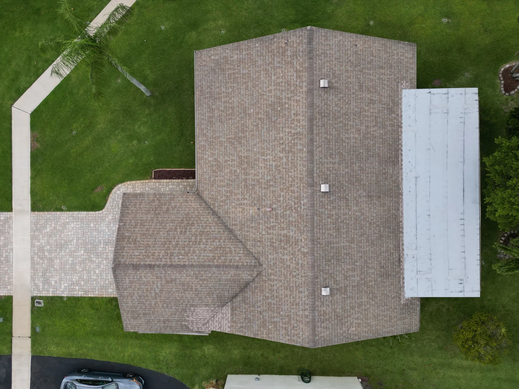
Drone Roof Inspection: What It Can and Cannot Show
A practical guide to planning aerial roof imagery, understanding its limits and getting a useful record for the next decision.
A drone roof inspection is most useful when it answers a specific property question. A manager may need a clear view after a storm, a facilities team may need a record before planning maintenance, or an owner may want to understand a concern on a high, steep or difficult-to-access roof. In each case, the goal is not simply to fly over the building. It is to collect images that make the next decision easier.
The strongest aerial roof inspections pair a clear scope with organized delivery. They show the roof in context, document the areas that matter and make it easy for the right person to review a concern. They also have limits. Aerial imagery can reveal visible conditions and help prioritize follow-up, but it cannot replace a hands-on evaluation, a repair diagnosis or a safety assessment of the roof itself.
Start with the decision the images need to support
Before scheduling a flight, define the question. It may be as simple as documenting the present condition of a roof before a lease review, comparing an area after a weather event or showing a contractor where a visible concern appears. For a commercial property, it might involve roof drains, flashing, parapet walls, rooftop equipment, penetrations or areas where water tends to collect.
That question determines the coverage. A broad overview can show roof layout, access points, equipment and drainage patterns. Closer oblique images can make a parapet, vent, seam or flashing detail easier to assess. A short, written scope keeps the flight focused and avoids a common problem: plenty of attractive footage, but no images that answer the question the property team actually asked.
The existing roof inspection field work gives a useful reference for the kind of site context an aerial assignment can provide. Share any past report, maintenance note or reference image before the flight so the capture plan can prioritize the right areas.
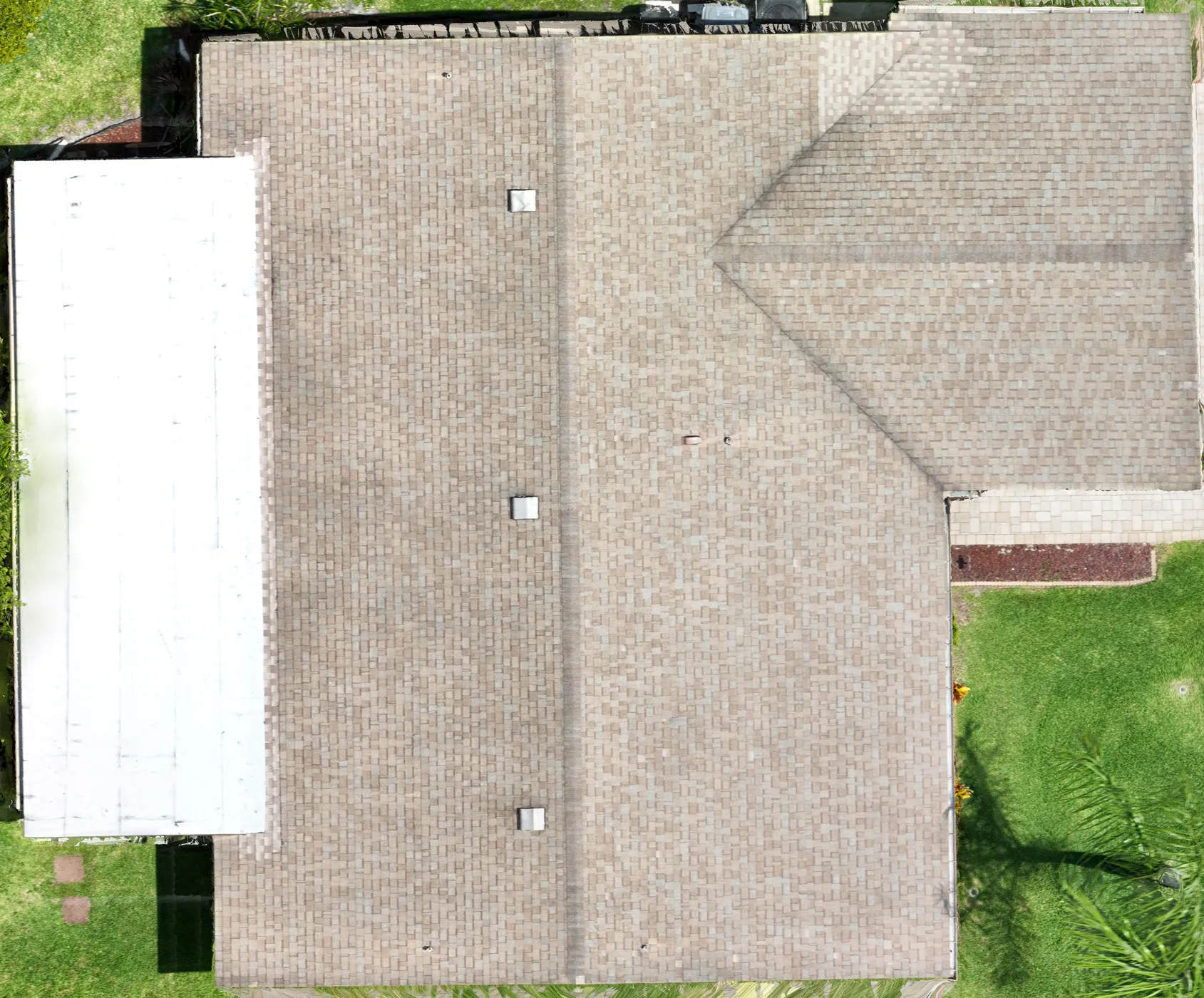
What a drone roof inspection can show clearly
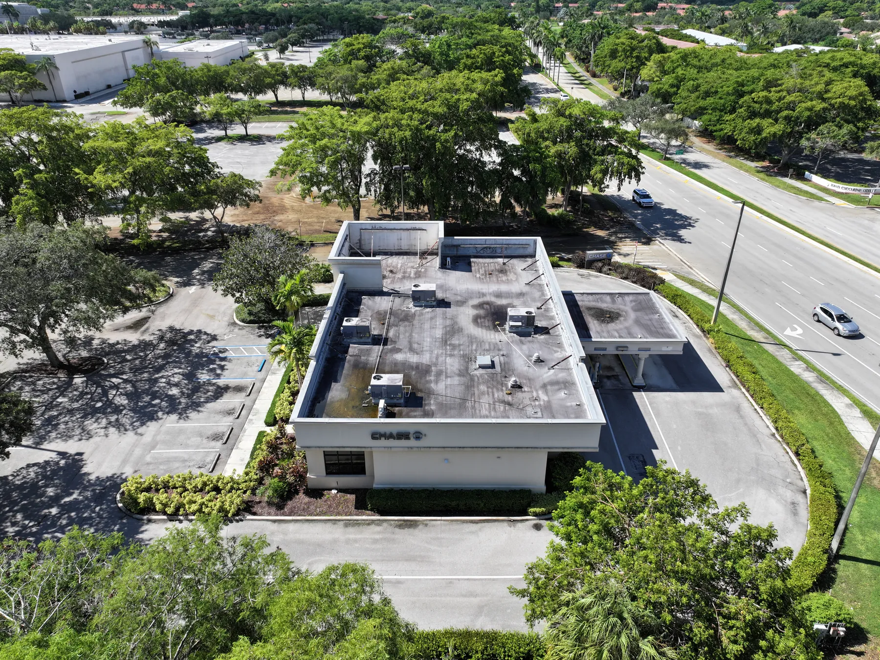
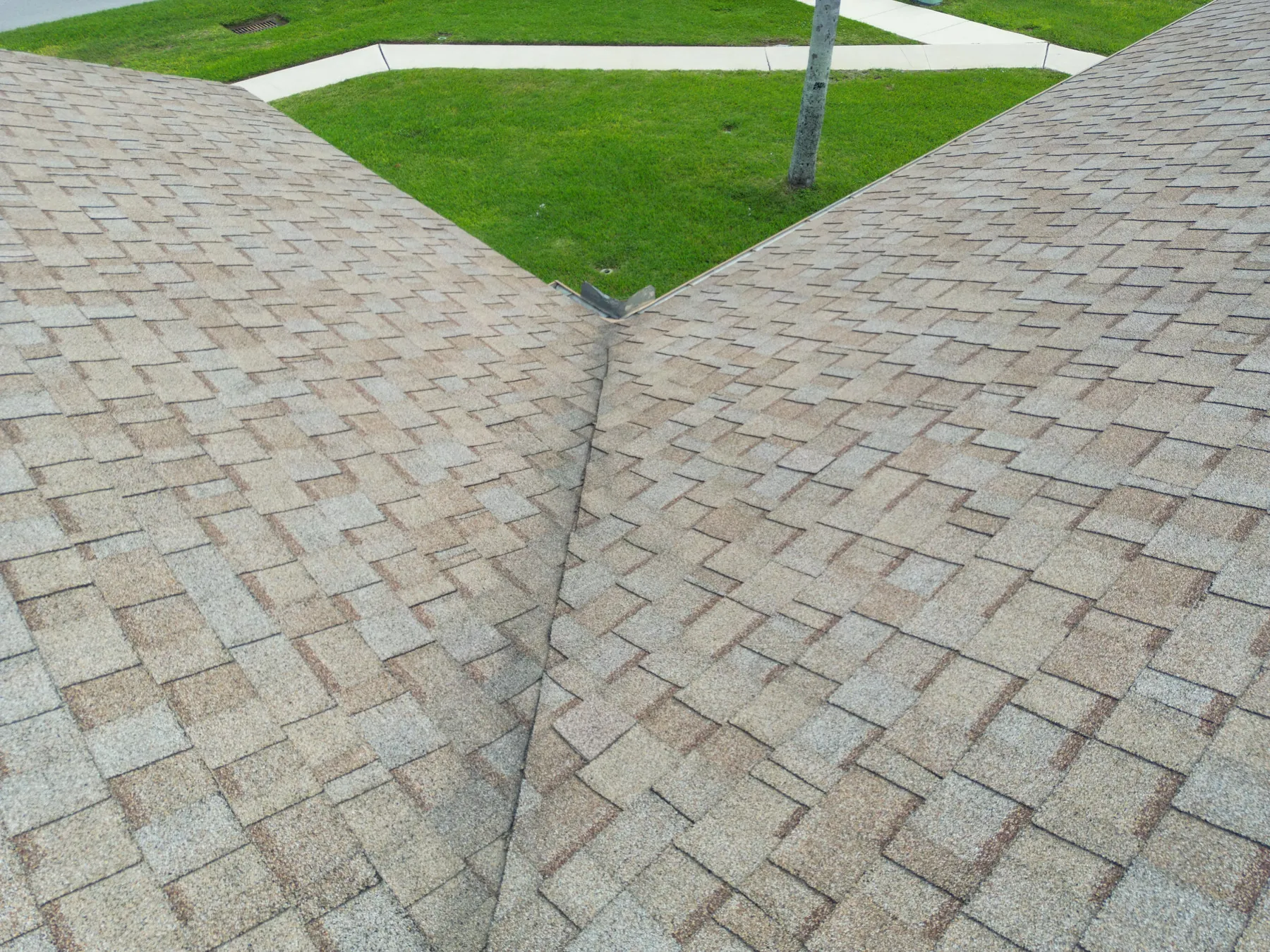
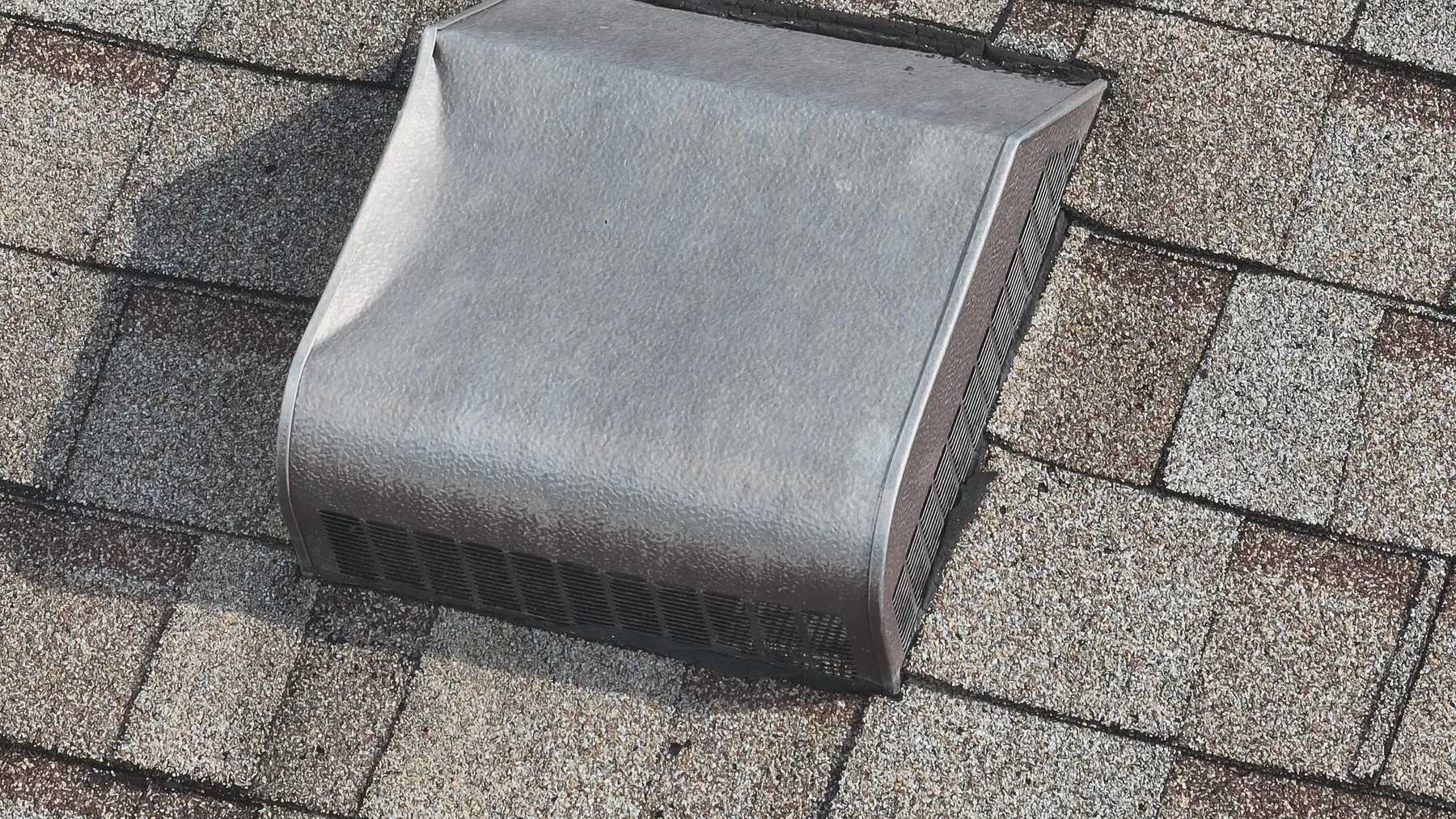
High-resolution aerial imagery is especially useful for visible roof conditions that are hard to understand from the ground. Depending on the roof and the camera angle, it can document loose debris, ponding water, displaced or damaged materials, stained areas, open or blocked drainage paths, roof-edge conditions, penetrations, flashing, skylights, rooftop units and the relationship between equipment and the surrounding roof surface.
The wider view matters as much as the close-up. An isolated photo of a drain or damaged edge is easier to use when the viewer can also see where it sits on the roof. A good inspection set usually moves from full-roof orientation to roof sections, then to the specific conditions that need attention. That sequence helps a facilities manager, roofer or insurer start from the same visual reference.
The New York City Department of Buildings report on drone inspections notes that aerial capture can help cover large roof areas and locate potential water-penetration or damaged-material concerns without having staff walk the roof simply to find the likely locations. The key word is potential. The images are valuable for locating and documenting a condition, then directing the appropriate follow-up.
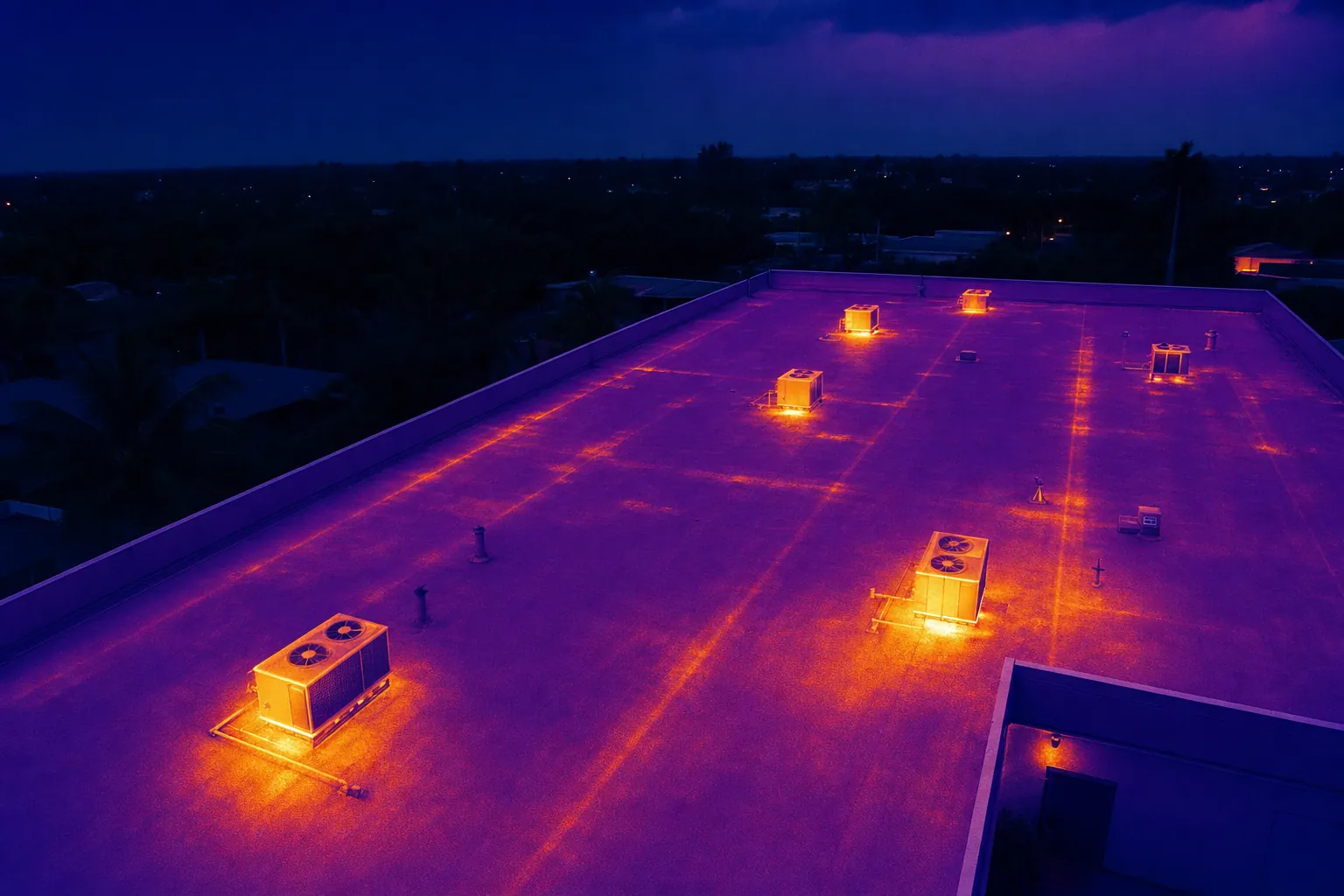
When thermal imaging adds a useful layer
Visible-light photography records what the roof surface looks like. Thermal imaging records surface-temperature patterns. That makes it useful when the property team needs another way to screen a roof, exterior equipment or an area of concern that may not be obvious in an ordinary photograph.
A temperature difference is a prompt for closer review, not a final diagnosis. Sun exposure, wind, recent rain, roof material, reflected heat, equipment operation and the time of day can all affect the result. The city report notes that reflective materials can make thermal readings more challenging, which is why camera setup and interpretation matter. A professional thermographer uses the image as one piece of evidence alongside the building conditions and the maintenance team's findings.
For a roof or equipment assignment where that additional layer is useful, West Boca Aerial Photography can combine aerial context with the thermal inspection service. The result should make the right follow-up easier to plan, not overstate what a single image can prove.
Know the limits before you rely on the result
A drone cannot lift a shingle, probe a soft deck, inspect an attic, confirm a hidden leak path or determine the root cause of a building problem from the air. It also cannot certify code compliance, guarantee the remaining life of a roof or replace the judgment of a qualified roofing, building-envelope or maintenance professional.
This is not a weakness in aerial capture. It is a reason to use it correctly. A drone can show a large roof safely and consistently, highlight the areas that deserve attention and provide a record that the owner can share with the right specialist. When an image reveals a concern, the next step is a closer review by the person qualified to diagnose and correct it.
Keep the language in the final report equally disciplined. Describe what is visible, where it appears and why the team may want to review it. Avoid conclusions that the imagery alone cannot support. That makes the record more credible, particularly when it will be used in maintenance planning, a property transaction or an insurance conversation.
Plan the flight around access, safety and airspace
A roof inspection flight begins on the ground. The pilot needs a safe launch and recovery area, a clear understanding of people, vehicles and contractors working nearby, access instructions, any restricted views and a practical route around trees, power lines, rooftop equipment and other obstacles. Property teams can help by sharing the site contact, work hours, active hazards and the areas that need attention before the flight date.
Commercial drone work also follows federal operating rules. The Federal Aviation Administration's Part 107 guidance requires commercial operators to follow the applicable operating and airspace requirements, including keeping the aircraft within sight and avoiding unsafe operations. Those requirements affect where a pilot can stand, which angles are practical and when a site can be flown without disrupting people below.
The best plan leaves room to adapt. Wind, rain, active deliveries, a closed access point or new work on the roof can change the safest approach. A focused shot list gives the pilot and site contact a way to preserve the priority views even when the exact route needs to change.
Ask for a deliverable that is usable after the flight
The flight is only useful if someone can find and understand the images later. Ask for a set organized by site, date and roof section, with overview images that establish orientation before the close views. For an issue-led inspection, include the images that show the concern in context and a concise note identifying the roof area or equipment location.
For a recurring program, consistency matters. Repeating the same broad views from comparable heights and angles makes it much easier to see change over time. A full aerial overview can also help the team point a contractor to the right zone without relying on vague descriptions such as "the back corner near the unit."
When the property needs a measured, repeatable site view rather than only perspective photography, a construction mapping assignment can add an orthomosaic or broader overhead record. It is a different deliverable with a different purpose, but it can complement inspection imagery when location context is important.
When to schedule a drone roof inspection
Aerial roof imagery is useful before maintenance planning, after a weather event, when access is difficult, during due diligence, before a roof replacement discussion or whenever a property team needs a current visual baseline. It can also help when a contractor, owner and manager need to review the same roof condition without sending every stakeholder onto the building.
The right schedule depends on the property and the question. A one-time flight may be enough for a focused concern. A property with recurring maintenance planning may benefit from a regular seasonal or annual record. What matters most is that the timing supports a real decision and that the capture plan stays consistent enough to make the next visit comparable.
Do not wait for the images to create the process. Decide in advance who receives the delivery, who reviews any flagged condition and what follow-up path applies. That small amount of planning is what turns aerial imagery into an operational record rather than a folder of files.
How West Boca Aerial Photography supports roof inspections
West Boca Aerial Photography plans roof and property inspection coverage around the condition the client needs to understand. Assignments can include high-resolution aerial imagery, thermal capture and organized views that show both the full roof and the details that deserve a closer look.
For a useful flight plan, share the property address, roof type, access details, active site conditions, the reason for the inspection and any views that need to be repeated. The team's pilot credentials, thermal capability and existing roof inspection work provide a practical starting point for planning the right coverage.
Frequently asked questions
What can a drone roof inspection find?
A drone can document visible roof conditions such as debris, ponding water, drainage paths, material damage, flashing, penetrations, skylights and rooftop equipment. It is especially useful for showing the location of a concern within the wider roof layout. The images can guide a closer review, but they do not diagnose hidden conditions or replace a qualified roof assessment.
Can a drone roof inspection replace a physical inspection?
No. Aerial imagery can reduce the need to walk a roof just to document visible conditions, but it cannot inspect an attic, probe materials, confirm a hidden leak path or establish the root cause of a problem. Use a drone inspection to identify and document areas that may need a qualified hands-on evaluation.
When is thermal drone imaging useful for a roof?
Thermal imaging can add another layer of information when a property team needs to screen a roof or rooftop equipment for temperature differences. The result depends on the weather, surface conditions, timing and interpretation, so it should be used as a prompt for follow-up rather than a stand-alone diagnosis.
What should a property manager provide before a drone roof inspection?
Provide the site address, a primary contact, access instructions, active hazards, work hours, restricted areas and the question the images need to answer. Maintenance notes, recent weather information and reference images are also helpful when the goal is to document a known concern or repeat an earlier view.
Related posts
Drone Inspection Report: What to Ask For
A practical guide to turning aerial imagery into an organized record that helps property and project teams decide what happens next.
Read the guide →Solar Panel Thermal Inspection: What a Drone Can Show
A practical guide to planning thermal aerial coverage, reading the images responsibly and directing the right follow-up.
Read the guide →
Drone Roof Inspection Cost: What Shapes the Quote
A practical guide to the site, scope and deliverables that determine the cost of a useful aerial roof inspection.
Read the guide →